

You are here
Avalanche Forecast for 2020-12-24 06:25
- EXPIRED ON December 25, 2020 @ 6:25 amPublished on December 24, 2020 @ 6:25 am
- Issued by Nick Meyers - Shasta-Trinity National Forest
Bottom Line
Avalanche danger is LOW. Exercise normal caution and soak up a little sun for one more day before things change. A winter storm warning has been issued for Christmas Day and into the weekend.


Avalanche Problem 1: Normal Caution
-
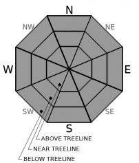
Character ?

-
Aspect/Elevation ?
One more day of LOW danger and normal caution. A little message fatigue going on here.
By now you should have your skis out, dusted off, waxed, sharpened and ready. You replaced the batteries in your beacon, turned it on, went through a function check, did a search in the backyard. Your boots might have a spider, or two, or a mouse in them, but you took care of that. You went through your pack, dialed it out, called your buddy and getting stoked. Game time.
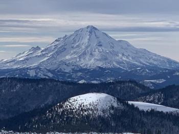
We are staring down the barrel of our first, real winter storm that will hopefully launch us into snowy oblivion. Heavy snowfall and windy conditions are expected tomorrow. We are still building our snowpack base in many areas. It will be important to pay attention to where existing, uniform snow cover exists. These areas may be the most avalanche prone with the incoming storm this weekend. The steep W/NW/N/NE facing slopes of Gray Butte comes to mind immediately.
Forecast Discussion
Winter this year has been like that old jalopy sitting in the yard that you know runs, but just won't start. She has sputtered a few times, but struggled to get going. On Christmas Day, winter will roar to life. A storm warning has been issued by the NWS and is in effect from 10a.m. Friday to 10a.m. PST Saturday above 3,500 feet. Get ready.
- Mt. Shasta City precipitation stats: 18% of normal for the wet season, 12% of normal for the month and 37% of normal for the year.
Couple Reminders:
- Please do no 4x4 into Sand Flat. This area goes to non-motorized in the winter and is reserved for cross-country skiers. There are hundreds of miles of other FS roads to get your wheelin' on. Cheers!
- Despite our best interest to stay home due to the virus, many will probably still travel to other areas searching for deep, beautiful powder. Many regions across the west are experiencing a very weak snowpack resulting in avalanches and fatalities. Go to https://avalanche.org/ and READ THE FORECAST. Know Before You Go, powder people.
Recent Observations
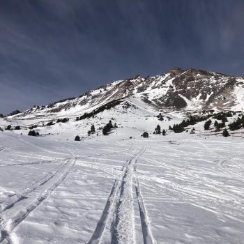
- Snow depth averages 0-24 inches across the forecast area. The "best" coverage on the mountain remains below and near treeline. Incessant wind from all directions has scoured above treeline terrain quite well. Gullies remain about the only skiable terrain.
- Most remaining snow has become crusty and wind packed. Select areas in only the most protected, cold, north facing terrain might host soft snow.
- Avalanches? We have no recorded avalanches this year.
- Yep, you guessed it...a lot of rock, brush and tree obstacles are the main hazard at this time
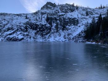
- Castle Lake is mostly frozen and ice skating is possible on the cold (south/southwest) side of the lake. Go skating today as it will be covered in snow tomorrow. observation/photos here
- We've found a few areas on northerly aspects hosting weak layers of sugary snow mid-way down in the shallow snowpack. Avalanche starting zones are overwhelmingly devoid of snow making these layers a low concern at this time.
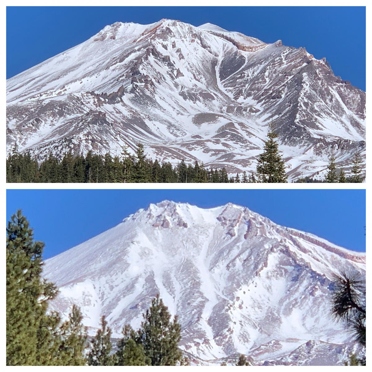
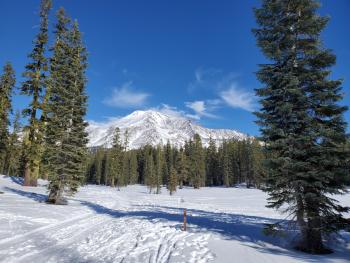
Photos from yesterday, the current (sad) situation on the mountain. The one thing about starting off with a dismal winter is that it hasn't been too crowded! [Photo: Meyers]
Weather and Current Conditions
Weather Summary
It's Christmas Eve and Santa is feverishly rigging is sleigh and prepping the reindeer. It's no small task. This year, Santa will need to get his rounds in before a good-looking snow storm enters our area on Christmas Day. A low pressure, frontal boundary will move across the Pacific Northwest on Christmas. Precipitation will spread inland through the day. Snow levels will start around 5 to 6,000 feet, but lower quickly to near 3,000 feet on Saturday. Precipitation rates (snow) could be more than 1 inch per hour at times. Expect moderate to high, southerly wind. This snow will likely be heavy and wet, just what we need to plaster the mountain. Upwards of 10-15 inches of fresh snow is possible by storm end. Batten the hatches for perhaps the best Christmas present of all! We're excited about this storm for tomorrow...but, today is a repeat of partly cloudy to mostly sunny skies.
24 Hour Weather Station Data @ 5:00 AM
| Weather Station | Temp (°F) | Wind (mi/hr) | Snow (in) | Comments | ||||||||
|---|---|---|---|---|---|---|---|---|---|---|---|---|
| Cur | Min | Max | Avg | Avg | Max Gust | Dir | Depth | New | Water Equivalent | Settlement | ||
| Mt. Shasta City (3540 ft) | 21 | 18 | 40 | 27.5 | 2 | N | ||||||
| Sand Flat (6750 ft) | 31 | 17 | 45 | 34 | 24 | 0 | Snow depth measured by hand. Depth sensor not working. | |||||
| Ski Bowl (7600 ft) | 32.5 | 31 | 42 | 37.5 | 19.9 | 0 | 0 | 0.5 | ||||
| Gray Butte (8000 ft) | 31 | 31 | 43.5 | 37 | 20 | 49 | E | |||||
| Castle Lake (5870 ft) | 33.5 | 24.5 | 38.5 | 33 | 7 | 0 | 0 | |||||
| Mount Eddy (6509 ft) | 34 | 26 | 40.5 | 36 | 2 | 7 | SW | 15.4 | 0 | 0.2 | ||
| Ash Creek Bowl (7250 ft) | 35 | 22.5 | 47 | 36 | 22.9 | 0 | 0.9 | |||||
| Ash Creek Ridge (7895 ft) | 32 | 21.5 | 37.5 | 31.5 | 0 | 0 | N |
Two Day Mountain Weather Forecast
Produced in partnership with the Medford NWS
| For 7000 ft to 9000 ft | |||
|---|---|---|---|
|
Thursday (4 a.m. to 10 p.m.) |
Thursday Night (10 p.m. to 4 a.m.) |
Friday (4 a.m. to 10 p.m.) |
|
| Weather | Partly cloudy/Mostly sunny | Partly cloudy becoming mostly cloudy with a slight chance of snow. Breezy. | Breezy, mostly cloudy with snow. Snow could be heavy at times. Snow level near 3,700 feet. |
| Temperature (°F) | 37 | 29 | 28 |
| Wind (mi/hr) | South 0-10 | South 5-15 | South 5-15 |
| Precipitation SWE / Snowfall (in) | 0.00 / 0 | 0.00 / 0 | 0.87 / 4-8 |
| For 9000 ft to 11000 ft | |||
| Thursday | Thursday Night | Friday | |
| Weather | Mostly sunny, windy. | Mostly cloudy, windy, slight chance of snow. | Snow, mainly after 10am. Snow heavy at times. Widespread blowing snow, temps falling, windy. |
| Temperature (°F) | 36 | 25 | 24 |
| Wind (mi/hr) | South 20-30 | South 30-40 | South 35-45 |
| Precipitation SWE / Snowfall (in) | 0.00 / 0 | 0.00 / 0 | 0.87 / 6-10 |
Season Precipitation for Mount Shasta City
| Period | Measured (in) | Normal (in) | Percent of Normal (%) |
|---|---|---|---|
| From Oct 1, 2025 (the wet season) | 2.42 | 13.15 | 18 |
| Month to Date (since Jun 1, 2026) | 0.72 | 5.79 | 12 |
| Year to Date (since Jan 1, 2026) | 15.33 | 41.15 | 37 |

