

You are here
Avalanche Forecast for 2021-03-05 06:21
- EXPIRED ON March 6, 2021 @ 6:21 amPublished on March 5, 2021 @ 6:21 am
- Issued by Nick Meyers - Shasta-Trinity National Forest
Bottom Line
Winter weather will break a two-week dry spell later today. This front has already brought strong, southerly wind to the area. Snow and blizzard conditions are on deck for tonight. New snow totals of 6-8 inches is forecast for the mountains. Wind slabs return to the problem list and the avalanche danger will rise following the storm onset.
Continue to be cautious of rockfall and slide for life conditions on steeper slopes in alpine terrain on the mountain.


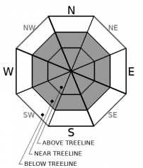
Avalanche Problem 1: Wind Slab
-
Character ?

-
Aspect/Elevation ?
-
Likelihood ?CertainVery LikelyLikelyPossible
 Unlikely
 -
Size ?HistoricVery LargeLargeSmall

The majority of the daylight hours today will host low avalanche danger and strong wind. As the winter storm begins this evening, expect blizzard conditions and snow heavy at times. New wind slabs will form on old, firm, slick snow surfaces. In some areas near ridgelines and bowls, avalanche starting zones are still bare ground. Late tonight and tomorrow, wind slabs will be most sensitive to trigger. Any dawn patrollers tomorrow should use caution near and above treeline on steep, wind loaded terrain. South to west wind will continue, loading north and east aspects.
Forecast Discussion
We've received more inquiries than normal about climbing the mountain recently. We never want to discourage anyone from getting out and enjoying the great outdoors. With that said, your safety is important to us and accidents on the mountain boil down to a few common denominators. One of those is poor climbing conditions such as we have currently. A shallow snowpack, exposed rock and slick, icy surfaces mean rockfall and long slips and falls are possible. The ante is up right now and consequences are higher for mistakes made. Please, be careful and make good decisions. The mountain will always be there.
Recent Observations
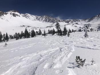
Our dry winter (45% of normal) is the talk of the town. Wind has been relentless. We have not received any precipitation since February 20th. Despite all this, the wind as an artist and the rawness of the mountain is a sight to see. Yesterday brought gale force wind to all areas. Giant plumes of dirt and snow could be seen spooling off ridgelines and summits. Check out recent obs from Castle Lake/Castle Spire and the North Side.
There is 67 inches of snow at 7,600 ft on Mount Shasta. In the last 24 hours, near treeline temperatures have averaged 27 ºF (7 degrees cooler than yesterday) and peaked at 33 (12 degrees cooler). Measured winds have been strong out of the south.
Dirt and exposed and fallen rock will be found above treeline. Climbing routes do not hold much snow. Backcountry users will find inconsistent snow surface conditions - soft to firm, sastrugis, crusts, and wind affected chalk. South and east facing slopes in the early afternoon were decent yesterday at Castle Lake.
Castle Lake still has a usable snowpack, though manzanita is beginning to poke through on Right Peak. Snow depth is 61 inches. Temperatures peaked there yesterday at 39.5 ºF (14 degrees cooler than yesterday). The lake is frozen and supportable.
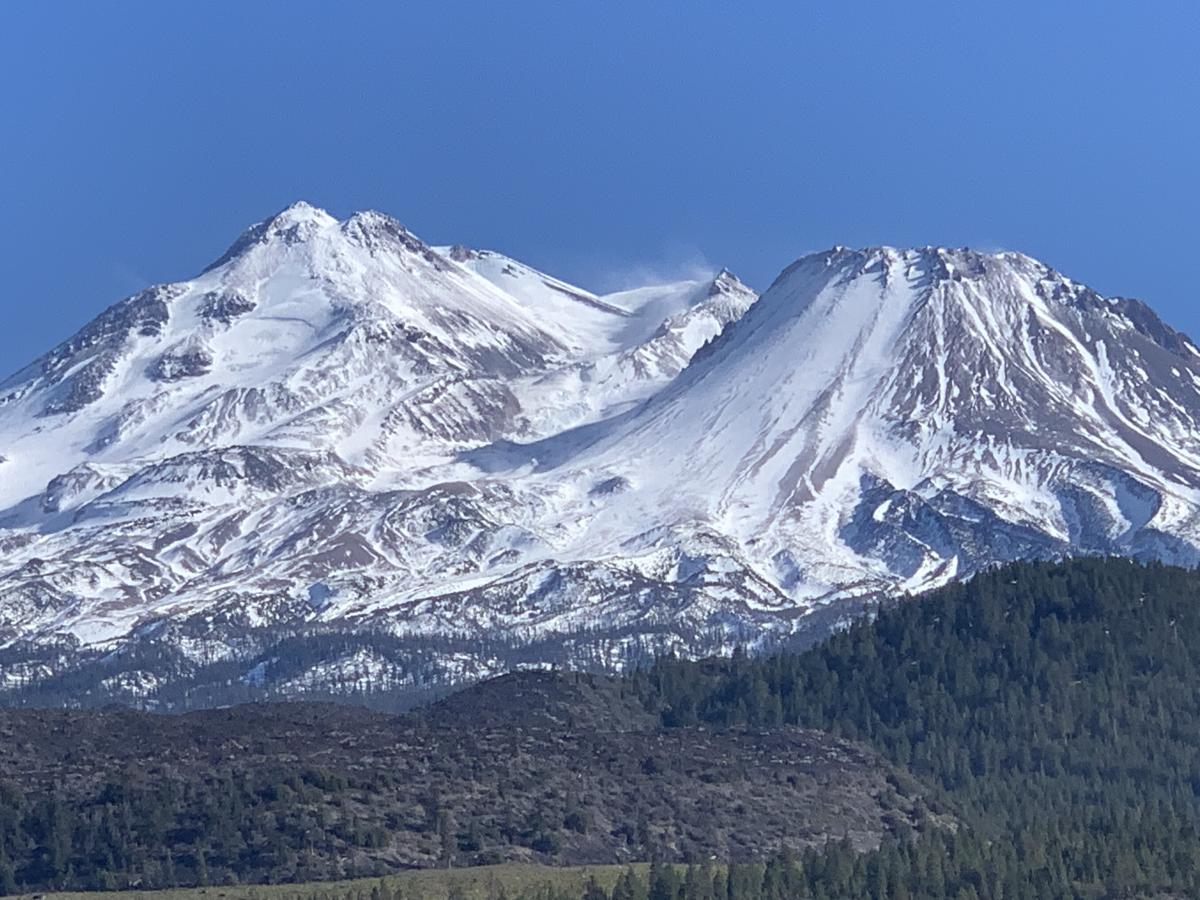
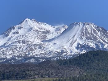
A spectacular view of Shastina and the north side of Mt. Shasta on 3.4.21. Notice the plume of spindrift coming off Misery Hill area. Southerly wind was cranking all day long and into the night. Glacier features such as bergschrunds and crevasses are exposed and climbing routes have large sections of hard ice. A slip and fall with such conditions can be deadly. [Photo: N Meyers]

Weather and Current Conditions
Weather Summary
A NWS winter weather advisory is in effect from 4pm this afternoon to 4am PST Saturday above 3,000 feet. Blizzard conditions on the upper mountain today and tonight with high winds, snow and blowing snow is expected. A strong frontal system offshore will finally push eastward. Winds have been very strong in advance of the front. Precipitation will begin late this afternoon and into the night. Water totals of .65" is forecast, which could mean 6-8 inches of new snow in the mountains by tomorrow. All this will be accompanied by strong southerly wind. Longer term, unsettled weather is the word on the street, albeit no huge whoppers.
24 Hour Weather Station Data @ 5:00 AM
| Weather Station | Temp (°F) | Wind (mi/hr) | Snow (in) | Comments | ||||||||
|---|---|---|---|---|---|---|---|---|---|---|---|---|
| Cur | Min | Max | Avg | Avg | Max Gust | Dir | Depth | New | Water Equivalent | Settlement | ||
| Mt. Shasta City (3540 ft) | 41 | 37 | 51 | 43.5 | 5 | E | ||||||
| Sand Flat (6750 ft) | 30 | 26 | 37 | 31 | Snow sensor down | |||||||
| Ski Bowl (7600 ft) | 25.5 | 22.5 | 33 | 27 | 67.5 | 0 | 0 | 0.2 | ||||
| Gray Butte (8000 ft) | 23 | 20.5 | 31 | 25 | 10 | 37 | S | |||||
| Castle Lake (5870 ft) | 30.5 | 26 | 39.5 | 32 | 59.5 | 0 | 1.7 | |||||
| Mount Eddy (6509 ft) | 28.5 | 25 | 34.5 | 29.5 | 3 | 7 | SW | 57 | 0.2 | 0 | ||
| Ash Creek Bowl (7250 ft) | 26 | 25 | 34.5 | 27.5 | 54.8 | 0 | 0.5 | |||||
| Ash Creek Ridge (7895 ft) | 22 | 21.5 | 28.5 | 23.5 | 16 | 53 | SSE |
Two Day Mountain Weather Forecast
Produced in partnership with the Medford NWS
| For 7000 ft to 9000 ft | |||
|---|---|---|---|
|
Friday (4 a.m. to 10 p.m.) |
Friday Night (10 p.m. to 4 a.m.) |
Saturday (4 a.m. to 10 p.m.) |
|
| Weather | Increasing clouds, snow, mainly after 4pm. Windy. Snow level near 4,900 feet. | Snow and windy. Snow level near 4,600 feet. | Lingering snow showers, then partly sunny. |
| Temperature (°F) | 33 | 22 | 31 |
| Wind (mi/hr) | South 15-25 | South 10-20 | West 0-10 |
| Precipitation SWE / Snowfall (in) | 0.01 / 0-1 | 0.60 / 6-8 | 0.04 / 0-1 |
| For 9000 ft to 11000 ft | |||
| Friday | Friday Night | Saturday | |
| Weather | Snow, mainly after 4pm. Very windy. | Snow, heavy at times. Very windy. | Chance of snow in the morning, becoming partly sunny. Windy. |
| Temperature (°F) | 24 | 9 | 18 |
| Wind (mi/hr) | South 65-75 | South 50-60 | West 10-20 |
| Precipitation SWE / Snowfall (in) | 0.01 / 1-2 | 0.60 / 7-11 | 0.04 / 1-2 |
Season Precipitation for Mount Shasta City
| Period | Measured (in) | Normal (in) | Percent of Normal (%) |
|---|---|---|---|
| From Oct 1, 2025 (the wet season) | 13.58 | 30.53 | 44 |
| Month to Date (since Jun 1, 2026) | 0.00 | 1.03 | 0 |
| Year to Date (since Jan 1, 2026) | 10.00 | 15.32 | 65 |

