

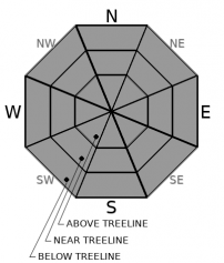
You are here
Avalanche Forecast for 2021-03-24 06:15
- EXPIRED ON March 25, 2021 @ 6:15 amPublished on March 24, 2021 @ 6:15 am
- Issued by Aaron Beverly - Mount Shasta Avalanche Center
Bottom Line
Avalanche danger is low. Slopes exposed to prolonged, direct sun may soften, but be prepared for mostly firm, icy conditions. A skiff of snow is expected late tonight after which spring conditions will prevail for at least a week.


Avalanche Problem 1: Normal Caution
-
Character ?

-
Aspect/Elevation ?
-
Likelihood ?CertainVery LikelyLikelyPossible
 Unlikely
 -
Size ?HistoricVery LargeLargeSmall

Expect firm conditions out there. Only slopes exposed to prolonged, direct sun, will soften. Slide for life conditions could be encountered. Make sure you have sharp edges on your skis and use your ice axe and crampons if ascending into steep terrain.
Blowing snow yesterday keeps some concern for wind slabs on the menu. Pay attention at very high elevations or in extreme terrain. They will probably be small, but could sweep you off your feet and onto a steep icy slope.
Recent Observations
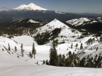
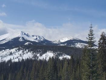
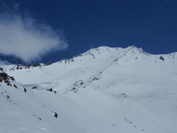
A tour around the Castle Lake cirque can mostly be described as firm. We got no ski penetration from Left Peak to the saddle between Middle and Right Peak. Large cornices were overhanging but rock hard. North winds were keeping the snow cool despite the sunny weather. Aspects exposed to direct sun all day were softening up in the early afternoon, but were still a bit crusty.
Some snow was seen blowing in the Eddies, though none was available for transport around Castle Lake. High on Mount Shasta, above the Red Banks, strong winds were blowing the remaining low density snow off north facing aspects.
Temperatures peaked at 35 ºF around 3 p.m. on Mount Shasta yesterday. Recorded winds were light, but, as evidenced by blowing snow, was moderate to strong high above treeline.
Weather and Current Conditions
Weather Summary
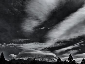
A warm front moves in this afternoon. Snow levels will start at 5,100 ft, but will drop to 3,500 ft early tomorrow as the front passes through. We might get a skiff of snow out this, but I suspect we'll barely notice - then a period of warmer temperatures and melt-freeze cycles and that yearning to start planting your gardens. Know that winter may not be over yet, but it will be for at least a week.
24 Hour Weather Station Data @ 4:00 AM
| Weather Station | Temp (°F) | Wind (mi/hr) | Snow (in) | Comments | ||||||||
|---|---|---|---|---|---|---|---|---|---|---|---|---|
| Cur | Min | Max | Avg | Avg | Max Gust | Dir | Depth | New | Water Equivalent | Settlement | ||
| Mt. Shasta City (3540 ft) | 34 | 29 | 38 | |||||||||
| Sand Flat (6750 ft) | 19 | 18 | 36 | 25 | 0 | 0 | Snow sensor down | |||||
| Ski Bowl (7600 ft) | 26.5 | 13.5 | 35.5 | 26.5 | 84.4 | 0 | 0.02 | 1.8 | ||||
| Gray Butte (8000 ft) | 28.5 | 12.5 | 32.5 | 25.5 | 6 | 37 | W | |||||
| Castle Lake (5870 ft) | 28.5 | 19 | 40 | 31 | 76.9 | 0 | 0.6 | |||||
| Mount Eddy (6509 ft) | 31.5 | 17 | 33.5 | 28.5 | 3 | 6 | SSW | 75.8 | 0 | 0.9 | ||
| Ash Creek Bowl (7250 ft) | 25.5 | 14.5 | 34 | 25 | 75.6 | 0 | 0.5 | |||||
| Ash Creek Ridge (7895 ft) | 21.5 | 11 | 28 | 20.5 | 4 | 15 | S |
Two Day Mountain Weather Forecast
Produced in partnership with the Medford NWS
| For 7000 ft to 9000 ft | |||
|---|---|---|---|
|
Wednesday (4 a.m. to 10 p.m.) |
Wednesday Night (10 p.m. to 4 a.m.) |
Thursday (4 a.m. to 10 p.m.) |
|
| Weather | Mostly sunny. | A 30 percent chance of snow. Mostly cloudy. | A 20 percent chance of snow showers before 11 a.m. Mostly sunny. |
| Temperature (°F) | 38 | 21 | 30 |
| Wind (mi/hr) | Northwest 5-10 | Northwest 10-15 | Northwest 10-15 |
| Precipitation SWE / Snowfall (in) | 0.00 / 0 | 0.01 / 0-0.25 | 0.00 / 0 |
| For 9000 ft to 11000 ft | |||
| Wednesday | Wednesday Night | Thursday | |
| Weather | Mostly sunny. Windy. Low wind chills. | A 40 percent chance of snow. Mostly cloudy. Windy. Low wind chills. | A 20 percent chance of snow showers before 11 a.m. Mostly sunny. Windy. Low wind chills. |
| Temperature (°F) | 28 | 11 | 20 |
| Wind (mi/hr) | Northwest 30-35 | Northwest 30-35 | North 30-40 |
| Precipitation SWE / Snowfall (in) | 0.00 / 0 | 0.01 / 0-0.25 | 0.00 / 0 |
Season Precipitation for Mount Shasta City
| Period | Measured (in) | Normal (in) | Percent of Normal (%) |
|---|---|---|---|
| From Oct 1, 2025 (the wet season) | 17.14 | 34.36 | 50 |
| Month to Date (since Jul 1, 2026) | 3.56 | 4.86 | 73 |
| Year to Date (since Jan 1, 2026) | 13.56 | 19.15 | 71 |

