

You are here
Avalanche Forecast for 2021-04-02 06:16
- EXPIRED ON April 3, 2021 @ 6:16 amPublished on April 2, 2021 @ 6:16 am
- Issued by Nick Meyers - Shasta-Trinity National Forest
Bottom Line
We are beginning to make the shift into climbing season on Mt. Shasta. Springtime avalanche problems are on the radar as well as increased rockfall concern and other climbing related hazards such as slips and falls on smooth, icy snow. Furthermore, the weather this time of year can bring the full nine yards. Plan ahead and prepare properly, check the weather, be honest with your own and group knowledge, skill and ability.


Avalanche Problem 1: Normal Caution
-
Character ?

-
Aspect/Elevation ?
-
Likelihood ?CertainVery LikelyLikelyPossible
 Unlikely
 -
Size ?HistoricVery LargeLargeSmall

Normal caution is advised in the backcountry today. Despite above freezing overnight temperatures, the snowpack should have blown off enough steam into the clear night sky for at least a thin refreeze. However, it's Spring and today's warm sunshine should melt through the refreeze without problem. Snow conditions will change from supportable to moist/wet mid-day. Keep an eyebrow raised for loose wet snow on steep slopes. Loose, wet snow that begins sliding downhill can gather more wet snow as it moves. Traditional pit tests don't work for loose-wet slides, but rollerballs, pinwheels and wet, sticky, ankle-deep snow are signs to watch for.
Forecast Discussion
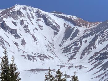
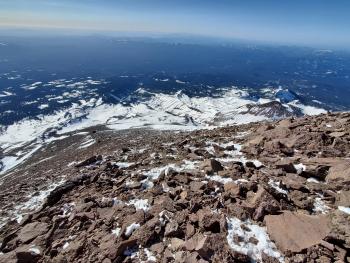
We've been wishing for a Spring atmospheric river event of some sort, but aside from our wishes, conditions will likely not get much better for climbing. Now is the time. We are a month or more ahead of schedule this year due to a winter that is 48% of normal for precipitation and accompanied by A LOT of wind. This has left the mountain above treeline a scoured, rocky heap and climbs this season will host more risk than normal. The climbing routes around The Heart and through Redbanks in Avalanche Gulch are already narrow and/or melted out. If ascending anywhere below exposed rocks, keep your head up and helmet on! Early spring climbs can bring a full range of weather. Check it before you plan your climb and be prepared. The Bunny Flat trailhead is the only open trailhead accessible by vehicle at this time.
Recent Observations
At treeline (7,600 feet) on Mount Shasta, we have 76 inches of snow on the ground and 66-69 inches over on the west side in the Castle Lake Basin and Eddy Mountains. Temperature averages over the past 3 days include a 41 °F degree mean, 32 °F low and 54.5 °F high. The wind has averaged 11 mi/hr, maxed out at 55 mi/hr and a minimum of 2 mi/hr, predominantly out of the west.
A handful of small, loose-wet slides have been observed and reported over the past week or so, but none large enough to cause human harm. High elevations have plenty of exposed rock and rockfall risk is higher than normal this year. Sections of steep, smooth and firm snow and ice exist all around the mountain. Slips and falls with conditions as such can serve high consequences.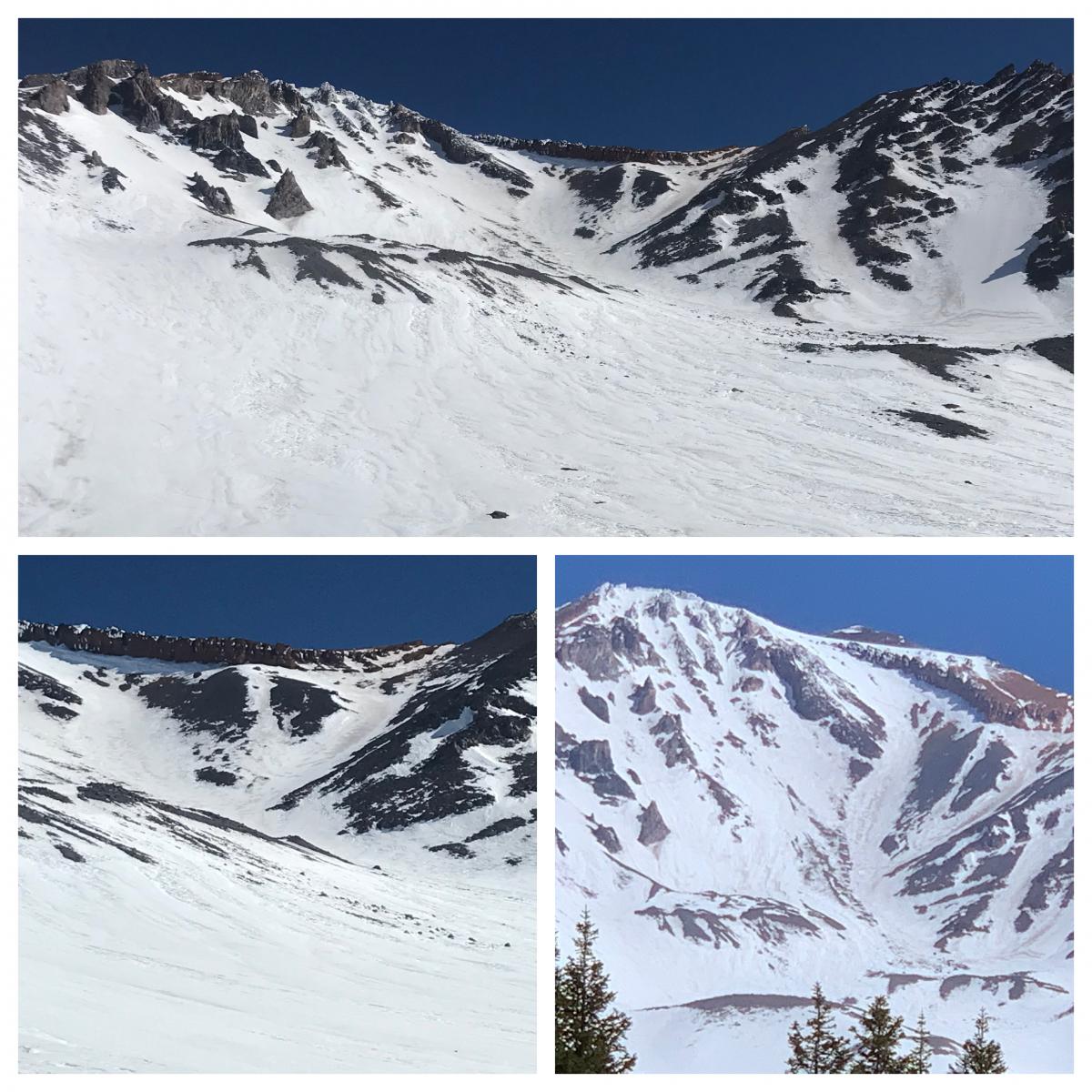
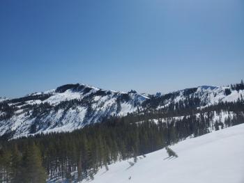
Avalanche Gulch from this week, 4.1.21 - More photos and detailed observation here.
Weather and Current Conditions
Weather Summary
Sunny and clear, not much else to say about that! Expect moderate wind (S/SW) on the upper mountain and over exposed terrain, but otherwise a nice day. High temperatures will be in the low 50's in the Bunny Flat (below treeline) area and in the 30's at Helen Lake (10,000 feet). There looks to be a chance of precipitation starting late Sunday/early Monday, but it'll come mostly in the form of rain. Models predict only 0.15" of water at this time.
24 Hour Weather Station Data @ 3:00 AM
| Weather Station | Temp (°F) | Wind (mi/hr) | Snow (in) | Comments | ||||||||
|---|---|---|---|---|---|---|---|---|---|---|---|---|
| Cur | Min | Max | Avg | Avg | Max Gust | Dir | Depth | New | Water Equivalent | Settlement | ||
| Mt. Shasta City (3540 ft) | 35 | 32 | 69 | 51 | 1 | N | ||||||
| Sand Flat (6750 ft) | 35 | 32 | 54 | 42 | Snow sensor down | |||||||
| Ski Bowl (7600 ft) | 38 | 35.5 | 48 | 41.5 | 75.9 | 0 | 0 | 1.8 | ||||
| Gray Butte (8000 ft) | 37.5 | 35 | 45.5 | 39.5 | 10 | 31 | W | |||||
| Castle Lake (5870 ft) | 41.5 | 39 | 60.5 | 49.5 | 65.5 | 0 | 1.2 | |||||
| Mount Eddy (6509 ft) | 40 | 37 | 53.5 | 44.5 | 1 | 8 | S | 64.7 | 0 | 1.3 | ||
| Ash Creek Bowl (7250 ft) | 33 | 14 | 33 | 23.5 | 69.4 | 0 | 0.5 | |||||
| Ash Creek Ridge (7895 ft) | 35 | 34.5 | 45 | 38.5 | 14 | 40 | S |
Two Day Mountain Weather Forecast
Produced in partnership with the Medford NWS
| For 7000 ft to 9000 ft | |||
|---|---|---|---|
|
Friday (4 a.m. to 10 p.m.) |
Friday Night (10 p.m. to 4 a.m.) |
Saturday (4 a.m. to 10 p.m.) |
|
| Weather | Mostly sunny. | Partly cloudy. | Mostly sunny. |
| Temperature (°F) | 51 | 32 | 48 |
| Wind (mi/hr) | South 5-10 | South 5-10 | South 5-10 |
| Precipitation SWE / Snowfall (in) | 0.00 / 0 | 0.00 / 0 | 0.00 / 0 |
| For 9000 ft to 11000 ft | |||
| Friday | Friday Night | Saturday | |
| Weather | Sunny and windy. | Partly cloudy and windy. | Mostly sunny and windy. |
| Temperature (°F) | 31 | 28 | 31 |
| Wind (mi/hr) | Southwest 15-25 | Southwest 15-25 | Southwest 20-30 |
| Precipitation SWE / Snowfall (in) | 0.00 / 0 | 0.00 / 0 | 0.00 / 0 |
Season Precipitation for Mount Shasta City
| Period | Measured (in) | Normal (in) | Percent of Normal (%) |
|---|---|---|---|
| From Oct 1, 2025 (the wet season) | 17.15 | 35.57 | 48 |
| Month to Date (since Jul 1, 2026) | 0.00 | 0.11 | 0 |
| Year to Date (since Jan 1, 2026) | 13.57 | 20.36 | 67 |

