

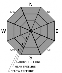
You are here
Avalanche Forecast for 2020-02-20 05:50
- EXPIRED ON February 21, 2020 @ 5:50 amPublished on February 20, 2020 @ 5:50 am
- Issued by Nick Meyers - Shasta-Trinity National Forest
Bottom Line
Avalanche danger is LOW. Exercise normal caution. Be prepared for a firm snowpack. Bring an ice axe, crampons, and helmet if ascending high into the alpine. Know how to self-arrest. Beware of falling rock. Mostly clear, dry weather will continue.


Avalanche Problem 1: Normal Caution
-
Character ?

-
Aspect/Elevation ?
-
Likelihood ?CertainVery LikelyLikelyPossible
 Unlikely
 -
Size ?HistoricVery LargeLargeSmall

Avalanche danger is low, but stay in the habit of carrying your avalanche rescue gear: a beacon, shovel, and probe. Take this time to refresh your skills and practice with them. We promise more snow will fall from the sky, eventually.
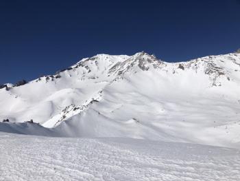
Fair weather is making a winter summit attempt favorable. Don't forget to purchase a SUMMIT PASS if ascending above 10,000 feet. Firm and icy snow conditions exist resulting in a long slip and fall hazard. Plan and prepare properly. Steep slopes that terminate into rock outcrops can exacerbate consequences. Crampons and an ice axe are essential. Proper self-arrest is mandatory should you slip and fall, or else a long slide-for-life is likely.
With large, exposed patches of rock on the mountain, expect rockfall, despite warm or cold temperatures. Wear a helmet and keep your head up.
If skiing or boarding, timing is everything. Pay attention to the sun and wind. Aspects with the longest and most direct sun exposure have seen softening snow, but only briefly - usually between 2 and 3 p.m. Wind and higher elevations may prevent even the sunniest of slopes from softening.
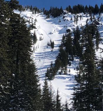
Recent Observations
- In the last 24 hours, Mount Shasta has received no new snow. Temperatures ranged between 24 and 33 degrees F. Winds have been moderate out of the E/SE, averaging 15 mi/hr with gusts to 31 mi/hr.
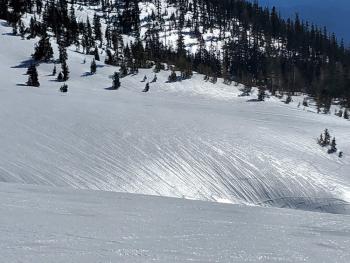
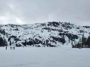
- Overall, the snowpack is stable, slick, and firm. Ridgelines have icy chicken heads and sastrugis. Bowls and gullies have a widespread, bubble-wrap textured surface.
- Wind protected, sun exposed aspects have been softening up briefly between 2 and 3 p.m.
Weather and Current Conditions
Weather Summary
Easterly winds and overcast sky is resulting in warmer temperatures this morning. Expect a few mid level clouds today, associated with a trough of low pressure pushing in from the Eastern Pacific. Don't let the words "low pressure" get your hopes up. High pressure ridging is expected over the area Friday into Saturday hosting clear, sunny weather. A few have perked up at the hopes of precipitation during the latter part of the weekend...unfortunately, recent models suggest no measurable precipitation making it to Mount Shasta. The extended forecast looks mostly dry. For the month of February, we've received .12 inches of water, normal is 4.78, an extremely sad 3% of normal. It's dryer than a popcorn fart out there folks!
24 Hour Weather Station Data @ 3:00 AM
| Weather Station | Temp (°F) | Wind (mi/hr) | Snow (in) | Comments | ||||||||
|---|---|---|---|---|---|---|---|---|---|---|---|---|
| Cur | Min | Max | Avg | Avg | Max Gust | Dir | Depth | New | Water Equivalent | Settlement | ||
| Mt. Shasta City (3540 ft) | 24 | 23 | 47 | 33.5 | 3 | N | ||||||
| Sand Flat (6750 ft) | 33 | 18 | 40 | 33 | 47 | 0 | 0 | 1 | ||||
| Ski Bowl (7600 ft) | 30.5 | 24.5 | 35 | 29.5 | 63 | 0 | 0 | 0 | ||||
| Gray Butte (8000 ft) | 28 | 24 | 33 | 28.5 | 15 | 31 | E | |||||
| Castle Lake (5870 ft) | 30.5 | 26 | 45.5 | 34 | 30 | 0 | 0 | |||||
| Mount Eddy (6509 ft) | 29 | 23 | 37 | 31 | 2 | 7 | WSW | 46 | 0 | 0 | ||
| Ash Creek Bowl (7250 ft) | down | |||||||||||
| Ash Creek Ridge (7895 ft) | down |
Two Day Mountain Weather Forecast
Produced in partnership with the Medford NWS
| For 7000 ft to 9000 ft | |||
|---|---|---|---|
|
Thursday (4 a.m. to 10 p.m.) |
Thursday Night (10 p.m. to 4 a.m.) |
Friday (4 a.m. to 10 p.m.) |
|
| Weather | Partly sunny | Mostly cloudy | Mostly sunny |
| Temperature (°F) | 43 | 28 | 46 |
| Wind (mi/hr) | Southeast 5-10 | East 0-5 | East 0-5 |
| Precipitation SWE / Snowfall (in) | 0.00 / 0 | 0.00 / 0 | 0.00 / 0 |
| For 9000 ft to 11000 ft | |||
| Thursday | Thursday Night | Friday | |
| Weather | Partly sunny, breezy | Mostly cloudy | Mostly sunny |
| Temperature (°F) | 19 | 19 | 21 |
| Wind (mi/hr) | South 15-20 | South 10-15 | Southwest 5-10 |
| Precipitation SWE / Snowfall (in) | 0.00 / 0 | 0.00 / 0 | 0.00 / 0 |
Season Precipitation for Mount Shasta City
| Period | Measured (in) | Normal (in) | Percent of Normal (%) |
|---|---|---|---|
| From Oct 1, 2025 (the wet season) | 12.90 | 27.05 | 48 |
| Month to Date (since Jun 1, 2026) | 0.12 | 4.78 | 3 |
| Year to Date (since Jan 1, 2026) | 3.97 | 11.84 | 34 |

