

You are here
Avalanche Forecast for 2021-04-01 07:00
- EXPIRED ON April 2, 2021 @ 7:00 amPublished on April 1, 2021 @ 7:00 am
- Issued by Aaron Beverly - Mount Shasta Avalanche Center
Bottom Line
Warm days and cool nights continue. Loose wet avalanches, cornice breaks, and rock fall should be on your radar. But overall avalanche danger is low. If climbing this weekend, Saturday may present the best conditions for a summit attempt. There is a chance of precipitation starting early Sunday that could bring several inches of snow at high elevations. Be prepared for all conditions.


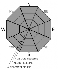
Avalanche Problem 1: Normal Caution
-
Character ?

-
Aspect/Elevation ?
-
Likelihood ?CertainVery LikelyLikelyPossible
 Unlikely
 -
Size ?HistoricVery LargeLargeSmall

Avalanche danger is low, but keep loose wet avalanches and cornice breaks on the radar. The upper snow pack is getting pretty soft in the sun and warm temperatures. These events are not catastrophic usually, but should not be ignored. Do you see rollerballs and pinwheels? Are you sinking up to your ankles? If so, avoid overhangng cornices and steep slopes.
Forecast Discussion
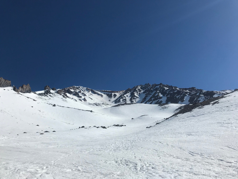
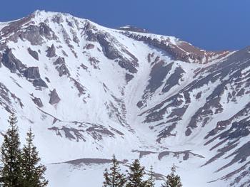
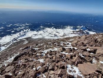
The way things are looking, it is probably going to be a short climbing season on the south side. The climbing routes around The Heart in Avalanche Gulch are already beginning to look narrow. If ascending below Red Banks, keep your head up, your helmet on, and be prepared for a game of dodgeball as rockfall will be possible.
Weather models are not in agreement on Sunday's precipitation, but a half of inch of precipitable water is possible. This means up to 5 inches of snow at high elevations. Saturday might present the best day for a summit attempt if you can swing it. Check the weather forecast before you climb and monitor it as you do so.
Recent Observations
It is almost feeling like summer out there on the mountain. It certainly was in town yesterday. Be prepared for firm conditions early in the morning, and thin to thick wet snow in the afternoon. That moment of perfect spring skiing is getting earlier in the day. High elevations have plenty of exposed rock and rockfall is not out of the question.
Some small wet loose slides have been seen on Mount Shasta and in the Carter Meadows area.
Temperatures near treeline peaked at 55 ºF around 1 p.m. yesterday and never made it below freezing. Winds were mostly light.
The Old Ski Bowl weather station is still chugging along. Keep your fingers crossed.
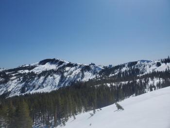
Below is the most recent picture of Avalanche Gulch.
Weather and Current Conditions
Weather Summary
Wash, rinse, repeat. Another sunny day is in store for you accompanied by light south winds and above freezing temperatures.
There looks to be a chance of precipitation starting early Sunday but it'll come mostly in the form of rain. Models are not in agreement, but optimistic numbers put the precipitable water at half an inch.
24 Hour Weather Station Data @ 5:00 AM
| Weather Station | Temp (°F) | Wind (mi/hr) | Snow (in) | Comments | ||||||||
|---|---|---|---|---|---|---|---|---|---|---|---|---|
| Cur | Min | Max | Avg | Avg | Max Gust | Dir | Depth | New | Water Equivalent | Settlement | ||
| Mt. Shasta City (3540 ft) | 33 | 33 | 71 | |||||||||
| Sand Flat (6750 ft) | 37 | 25 | 56 | 42 | 168 | 0 | 0 | 0 | Snow sensor down | |||
| Ski Bowl (7600 ft) | 36.5 | 36.5 | 54.5 | 44.5 | 77.7 | 0 | 0 | 1.8 | ||||
| Gray Butte (8000 ft) | 37.5 | 37.5 | 48.5 | 43.5 | 10 | 43 | ESE | |||||
| Castle Lake (5870 ft) | 39 | 36 | 65 | 49.5 | 66.8 | 0 | 2.1 | |||||
| Mount Eddy (6509 ft) | 37.5 | 32.5 | 57 | 46.5 | 2 | 5 | S | 66 | 0 | 1.2 | ||
| Ash Creek Bowl (7250 ft) | 33 | 14 | 33 | 23.5 | 69.4 | 0 | 0.5 | |||||
| Ash Creek Ridge (7895 ft) | 36 | 27.5 | 51.5 | 42.5 | 10 | 35 | S |
Two Day Mountain Weather Forecast
Produced in partnership with the Medford NWS
| For 7000 ft to 9000 ft | |||
|---|---|---|---|
|
Thursday (4 a.m. to 10 p.m.) |
Thursday Night (10 p.m. to 4 a.m.) |
Friday (4 a.m. to 10 p.m.) |
|
| Weather | Sunny. | Mostly clear. | Sunny, then becoming partly cloudy. |
| Temperature (°F) | 49 | 31 | 48 |
| Wind (mi/hr) | South 5-10 | Southwest 5-10 | South 5-10 |
| Precipitation SWE / Snowfall (in) | 0.00 / 0 | 0.00 / 0 | 0.00 / 0 |
| For 9000 ft to 11000 ft | |||
| Thursday | Thursday Night | Friday | |
| Weather | Sunny | Mostly clear. Breezy. | Sunny, then becoming partly cloudy. Breezy. |
| Temperature (°F) | 33 | 31 | 33 |
| Wind (mi/hr) | Southwest 15-20 | Southwest 20-25 | Southwest 20-25 |
| Precipitation SWE / Snowfall (in) | 0.00 / 0 | 0.00 / 0 | 0.00 / 0 |
Season Precipitation for Mount Shasta City
| Period | Measured (in) | Normal (in) | Percent of Normal (%) |
|---|---|---|---|
| From Oct 1, 2025 (the wet season) | 17.15 | 35.46 | 48 |
| Month to Date (since Jul 1, 2026) | 3.57 | 5.96 | 60 |
| Year to Date (since Jan 1, 2026) | 13.57 | 20.25 | 67 |

