

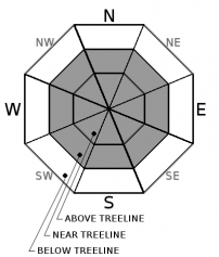
You are here
Avalanche Advisory for 2018-12-12 05:55
- EXPIRED ON December 13, 2018 @ 5:55 amPublished on December 12, 2018 @ 5:55 am
- Issued by Nick Meyers - Shasta-Trinity National Forest
Bottom Line
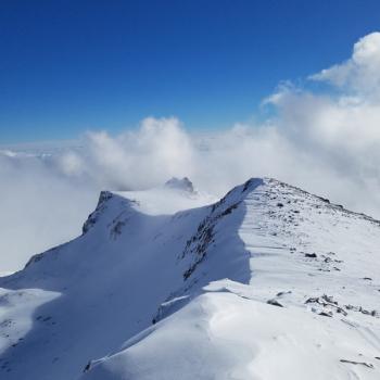
The avalanche danger is LOW at all elevations. LOW does not mean NO avalanche danger. Expect very windy conditions near and above treeline today. Look out for small isolated wind slabs on leeward slopes greater than 35 degrees.


Avalanche Problem 1: Wind Slab
-
Character ?

-
Aspect/Elevation ?
-
Likelihood ?CertainVery LikelyLikelyPossible
 Unlikely
 -
Size ?HistoricVery LargeLargeSmall

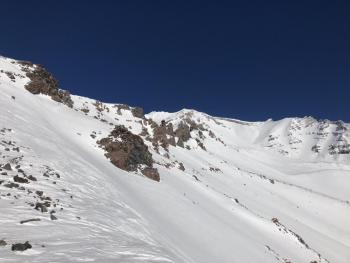
A bit of old and new snow accompanied by strong winds might contribute to the formation of small wind slabs, but these are unlikely to be of much concern. That said, LOW avalanche danger still means you should watch for unstable snow on isolated terrain features or in extreme terrain. Signs of wind slabs are wind pillows, wind textured snow surfaces, and cornice formation. If uncertainty exists, travel in more wind protected terrain.
Forecast Discussion
The Mount Shasta Ski Park opens today. Come out and partake in the winter fun!
Recent Observations
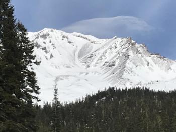
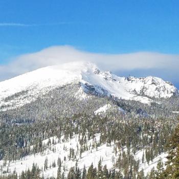
A cloudy and somewhat uninspiring day yesterday. A sporadic sun crust near the surface of the snowpack has made for variable conditions in the backcountry. Decent sliding and riding can be found for the savvy near and above treeline and in some protected areas. No avalanche related issues have been observed and we are in a holding period until more snow arrives. A trace of new snow fell over night. Winds are currently cranking on Gray Butte out of the northwest, 40-50 mph with gusts 60+. Continue to watch out for shallow buried objects.
Weather and Current Conditions
Weather Summary
The trough axis continues to move through leaving behind residual showers and breezy winds today. High pressure will begin to build however with partly cloudy skies. Temperatures should trend warmer as warmer air begins to push in from the west. Thursday is essentially the same story. Friday, a strong low deepens east of the 130 W longitude. Rain and snow is a little underwhelming at this point. Expect strong winds at higher elevations and several inches of snow in the mountains with snow levels near 4,300 feet. The extended forecast looks wet for Sunday, Monday and Tuesday.
24 Hour Weather Station Data @ 3:00 AM
| Weather Station | Temp (°F) | Wind (mi/hr) | Snow (in) | Comments | ||||||||
|---|---|---|---|---|---|---|---|---|---|---|---|---|
| Cur | Min | Max | Avg | Avg | Max Gust | Dir | Depth | New | Water Equivalent | Settlement | ||
| Mt. Shasta City (3540 ft) | 38 | 25 | 43 | 36.5 | 2 | N | ||||||
| Sand Flat (6750 ft) | 25 | 19 | 39 | 32 | 27 | 1 | 0 | 1 | ||||
| Ski Bowl (7600 ft) | 25.5 | 23 | 42.5 | 33 | 34.5 | 0.8 | 0.04 | 1.2 | ||||
| Gray Butte (8000 ft) | 26 | 21.5 | 39.5 | 31.5 | 21 | 67 | WNW | |||||
| Castle Lake (5870 ft) | 0 | 0 | 0 | 0 | 0 | 0 | 0 | station down | ||||
| Mount Eddy (6509 ft) | 26.5 | 26 | 42 | 35 | 2 | 18 | SE | 29.7 | 1.4 | 1.5 | ||
| Ash Creek Bowl (7250 ft) | station down | |||||||||||
| Ash Creek Ridge (7895 ft) | station down |
Two Day Mountain Weather Forecast
Produced in partnership with the Medford NWS
| For 7000 ft to 9000 ft | |||
|---|---|---|---|
|
Wednesday (4 a.m. to 10 p.m.) |
Wednesday Night (10 p.m. to 4 a.m.) |
Thursday (4 a.m. to 10 p.m.) |
|
| Weather | Patchy blowing snow before 10 a.m. Mostly sunny. Breezy. | Partly cloudy | Mostly sunny |
| Temperature (°F) | 35 | 32 | 42 |
| Wind (mi/hr) | N 10-15 | NW 5-10 | S 5-10 |
| Precipitation SWE / Snowfall (in) | / 0 | / 0 | / 0 |
| For 9000 ft to 11000 ft | |||
| Wednesday | Wednesday Night | Thursday | |
| Weather | Widespread blowing snow before 10am, mostly sunny and windy. Wind chill values in the negatives F. | Partly cloudy, windy. Wind chill as low as zero. | Mostly sunny, windy |
| Temperature (°F) | 22 | 22 | 31 |
| Wind (mi/hr) | NW 40-45 | NW 0 | W 25-30 |
| Precipitation SWE / Snowfall (in) | / 0 | / 0 | / 0 |
Season Precipitation for Mount Shasta City
| Period | Measured (in) | Normal (in) | Percent of Normal (%) |
|---|---|---|---|
| From Oct 1, 2025 (the wet season) | 5.16 | 9.93 | 52 |
| Month to Date (since Jul 1, 2026) | 0.43 | 2.57 | 17 |
| Year to Date (since Jan 1, 2026) | 20.44 | 37.93 | 54 |

