

You are here
Avalanche Forecast for 2019-03-05 06:00
- EXPIRED ON March 6, 2019 @ 6:00 amPublished on March 5, 2019 @ 6:00 am
- Issued by Aaron Beverly - Mount Shasta Avalanche Center
Bottom Line
Exercise normal caution in the backcountry today but always watch for unstable snow in isolated areas or extreme terrain. A winter storm will begin to bring significant snow after 4 p.m. above 4,000 feet. Avalanche danger will rise tonight as several inches of snow combine with south winds to create new wind slabs. Be wary of steep leeward slopes.


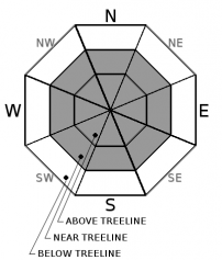
Avalanche Problem 1: Wind Slab
-
Character ?

-
Aspect/Elevation ?
-
Likelihood ?CertainVery LikelyLikelyPossible
 Unlikely
 -
Size ?HistoricVery LargeLargeSmall

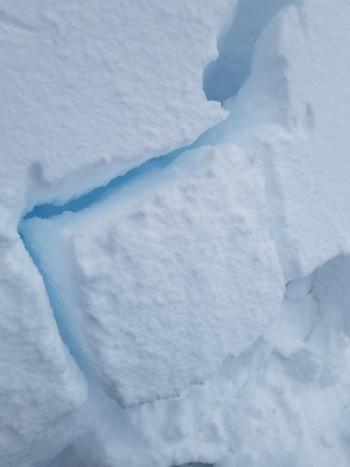
Wind slabs may begin to form late tonight as several inches of new snow combine with moderate to strong south winds. They will form primarily on W-N-E aspects but mountain winds can be variable so pay attention to where leeward areas reside. Stay away from steep slopes that have been loaded. Signs that wind slabs may be nearby are: shooting cracks, blocking, whumphing; convex pillows of wind-drifted snow; chalky, hollow sounding snow.
For most of today, avalanche danger will remain low. Watch for unstable snow in isolated areas or extreme terrain. Otherwise exercise normal caution which means:
- Have a plan, stick to the plan.
- Travel one at a time on and below steep slopes.
- Bring the gear and skills necessary for avalanche rescue.
Recent Observations
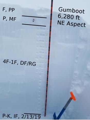
Height of snow in the Old Ski Bowl is 175 inches. In the last 24 hours, about half an inch of new snow has fallen and the snowpack has settled about 2 inches. Temperatures ranged from 20 to 32 degrees. Westerly and southerly winds winds have been light, averaging 7 mi/hr and gusting up to 18.
No recent avalanches or other signs of instability have been seen. The snowpack is generally stable and a surface crust exists at lower elevations. Higher elevations host a mix of settled dry snow, wind packed chalk, filled in sastrugis, and wind textured surfaces.
As of yesterday afternoon, Everitt Memorial Highway (road to Bunny Flat) and Castle Lake Road were closed. The county was hoping to open Everitt by the end of the day. There has been no word on that yet.
Weather and Current Conditions
Weather Summary
Wintry weather returns today as a warm front moves into the area. A winter storm warming comes into effect after 4 p.m. and continues until 10 p.m. tomorrow night.
In the next 24 hours, expect 4-8 inches of snow, moderate to strong south winds, and snow levels near 4,000 feet.
Tomorrow another 5-11 inches of snow is expected before 4 p.m. Precipitation will begin to diminish tomorrow night.
24 Hour Weather Station Data @ 5:00 AM
| Weather Station | Temp (°F) | Wind (mi/hr) | Snow (in) | Comments | ||||||||
|---|---|---|---|---|---|---|---|---|---|---|---|---|
| Cur | Min | Max | Avg | Avg | Max Gust | Dir | Depth | New | Water Equivalent | Settlement | ||
| Mt. Shasta City (3540 ft) | 35 | 32 | 44 | 38 | 1 | N | ||||||
| Sand Flat (6750 ft) | ||||||||||||
| Ski Bowl (7600 ft) | 21.5 | 19.5 | 31.5 | 24 | 174.6 | 0.7 | 0.07 | 1.8 | ||||
| Gray Butte (8000 ft) | 21.5 | 20 | 29.5 | 23 | 7 | 18 | W | |||||
| Castle Lake (5870 ft) | 28.5 | 26 | 40.5 | 30.5 | 138.6 | 1.2 | 2.6 | |||||
| Mount Eddy (6509 ft) | ||||||||||||
| Ash Creek Bowl (7250 ft) | ||||||||||||
| Ash Creek Ridge (7895 ft) |
Two Day Mountain Weather Forecast
Produced in partnership with the Medford NWS
| For 7000 ft to 9000 ft | |||
|---|---|---|---|
|
Tuesday (4 a.m. to 10 p.m.) |
Tuesday Night (10 p.m. to 4 a.m.) |
Wednesday (4 a.m. to 10 p.m.) |
|
| Weather | Snow, mainly after 10 a.m. Chance of precipitation is 80%. | Snow. The snow could be heavy at times. Blustery. Chance of precipitation is 100%. | Snow. The snow could be heavy at times. Chance of precipitation is 100%. |
| Temperature (°F) | 29 | 30 | 34 |
| Wind (mi/hr) | South 10-15 | South 15-20 | South 10-15 |
| Precipitation SWE / Snowfall (in) | / <1 | / 3-6 | / 5-9 |
| For 9000 ft to 11000 ft | |||
| Tuesday | Tuesday Night | Wednesday | |
| Weather | Snow, mostly after 10 a.m. Cloudy. Windy and gusty. Chance of precipitation is 70%. | Snow. The snow could be heavy at times. Windy and gusty. Chance of precipitation is 100%. | Snow. The snow could be heavy at times. Windy and gusty. Chance of precipitation is 100%. |
| Temperature (°F) | 18 | 18 | 19 |
| Wind (mi/hr) | South 25-30 | South <1 | Southwest 30-35 |
| Precipitation SWE / Snowfall (in) | / <1 | / 4-8 | / 7-11 |
Season Precipitation for Mount Shasta City
| Period | Measured (in) | Normal (in) | Percent of Normal (%) |
|---|---|---|---|
| From Oct 1, 2025 (the wet season) | 29.67 | 30.53 | 97 |
| Month to Date (since Jun 1, 2026) | 0.14 | 1.03 | 14 |
| Year to Date (since Jan 1, 2026) | 21.26 | 15.32 | 139 |

