

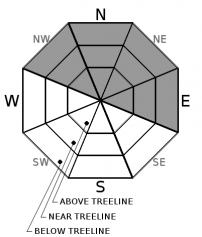
You are here
Avalanche Forecast for 2019-12-19 06:27
- EXPIRED ON December 20, 2019 @ 6:27 amPublished on December 19, 2019 @ 6:27 am
- Issued by Nick Meyers - Shasta-Trinity National Forest
Bottom Line
Today, a multi-day atmospheric river event begins. While modest snowfall totals are forecast, very strong southwesterly wind will move plenty of new snow around. Watch for wind blowing snow and pay close attention where wind loaded, leeward terrain exists. CONSIDERABLE wind slab avalanche danger may be attained near and above treeline on NW-N-NE-E facing aspects over the next 24 hours.


Avalanche Problem 1: Wind Slab
-
Character ?

-
Aspect/Elevation ?
-
Likelihood ?CertainVery LikelyLikelyPossible
 Unlikely
 -
Size ?HistoricVery LargeLargeSmall

Southwest/West wind has averaged 21 mph over the past 24 hours. Winds blowing from the same direction are forecast to increase tonight and tomorrow night to gale force speeds. Existing/new, soft snow will be available for transport. New wind slabs will form and small, existing slabs will gain size (D1-D2) and distribution, near and above treeline. Exposed areas below treeline, one might find small (D1), isolated wind slabs.
Pay attention to the wind over the next several days. Look for wind slabs on leeward NW-N-NE-E aspects. Shooting cracks, blocking, cornices,wind drifts, sudden hard/scoured snow to soft snow are all signs that winds slabs are forming. Use small test slopes to check how drifts may react to the weight of a person or sled.
Forecast Discussion
Atmospheric rivers can often wobble north and south over a multi-day duration, kind of like an unattended fire hose left on full blast. While winter weather is certainly expected, maximum rain and snowfall amounts are uncertain. Two periods of strong wind is forecast; Thursday night/Friday and Friday night/Saturday. So, while snowfall amounts are not overly impressive, pay attention to the wind blowing plenty of snow around.
How to Practice Avalanche Rescue
Recent Observations
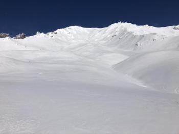
Yesterday on the south side of Mount Shasta, the weather did a fair amount of bluffing without much action. Snow flurries occurred for much of the day, but at 1600 hours only .25 to .5 inches of new snow was measured below treeline on the big mountain. Southerly wind was calm below treeline. Poor visibility limited near and above treeline travel. Wind was stronger in these areas, averaging 15 mph with gusts to 25 mph. Mount Shasta city experienced chilly temps and a trace of new snow. Measurable snow wasn't observed until 5,500 feet. Treeline temperatures (7,800 feet) averaged 22.5 F, with a high of 25 F and low of 17.5 F.
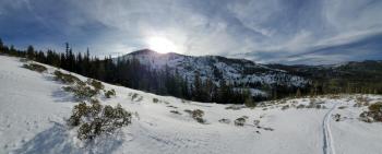
Snow surfaces are variable: firm and icy, wind affected, rimed, chalky, and breakable. Some near and below treeline terrain still hosts low density snow in north facing, shady, wind protected areas.
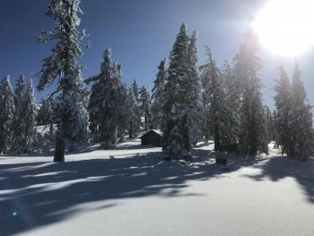
Two days ago, a thin layer of granular snow was widespread near and below treeline around Cliff Lake. Surface hoar was also observed in low lying, wind protected pockets below and near treeline in the Eddies.
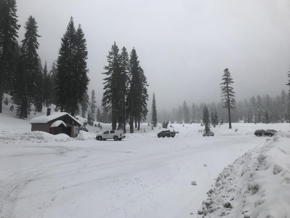
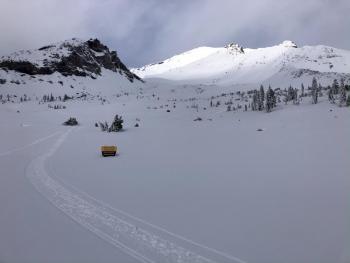
Bunny Flat, 6,960 elevation at 1600 hours on 12.18.19
Weather and Current Conditions
Weather Summary
A long stretching jet stream has taken aim at the west coast, making the transition into a wet and windy period of weather that will last through the weekend. While most of the precipitation will fall along the Coast Range and to the north of us, we won't be left high and dry. Today will be the first wave, hosting snow and increasingly windy conditions. Precipitation will diminish Friday and then pick back up Saturday afternoon into Sunday. South/Southwest winds are notable with the highest wind speeds peaking Friday evening / Saturday morning. Snow levels are on the higher side for the near future, in the 5-5,500 foot range. Saturday colder air moving in will lower snow levels to near 4,500 feet. All this action won't stop the show, but it should bring a nice freshen'up to the mountain landscape with upwards of 1.5 to 2 inches of precipitable water forecast through Saturday night.
24 Hour Weather Station Data @ 3:00 AM
| Weather Station | Temp (°F) | Wind (mi/hr) | Snow (in) | Comments | ||||||||
|---|---|---|---|---|---|---|---|---|---|---|---|---|
| Cur | Min | Max | Avg | Avg | Max Gust | Dir | Depth | New | Water Equivalent | Settlement | ||
| Mt. Shasta City (3540 ft) | 36 | 32 | 38 | 35.5 | 3 | ESE | ||||||
| Sand Flat (6750 ft) | 28 | 22 | 29 | 26 | 34 | 1 | n/a | 0 | ||||
| Ski Bowl (7600 ft) | 24.5 | 17.5 | 25 | 22.5 | 43 | 4 | 0.49 | 0 | ||||
| Gray Butte (8000 ft) | 22.5 | 15.5 | 24 | 21 | 11 | 25 | WSW | |||||
| Castle Lake (5870 ft) | 0 | 0 | 0 | 0 | 0 | 0 | 0 | down | ||||
| Mount Eddy (6509 ft) | 28 | 20.5 | 29.5 | 26.5 | 2 | 16 | SSW | 32 | .5 | 0 | ||
| Ash Creek Bowl (7250 ft) | down | |||||||||||
| Ash Creek Ridge (7895 ft) | down |
Two Day Mountain Weather Forecast
Produced in partnership with the Medford NWS
| For 7000 ft to 9000 ft | |||
|---|---|---|---|
|
Thursday (4 a.m. to 10 p.m.) |
Thursday Night (10 p.m. to 4 a.m.) |
Friday (4 a.m. to 10 p.m.) |
|
| Weather | Snow. Breezy. Snow levels near 5,000 feet. Chance of precipitation 90% | Snow. Windy. Snow levels near 5,500 feet. Chance of precipitation 70%. | Snow, mainly in the AM, becoming cloudy. Windy. Snow levels near 5,500 feet. Chance of precipitation 70%. |
| Temperature (°F) | 30 | 28 | 30 |
| Wind (mi/hr) | South 20-25 | South 20-25 | South 15-20 |
| Precipitation SWE / Snowfall (in) | 0.29 / 3-5 | 0.09 / 2-4 | 0.07 / 0-1 |
| For 9000 ft to 11000 ft | |||
| Thursday | Thursday Night | Friday | |
| Weather | Snow. Windy. Wind chill values as low as -7. Chance of precipitation is 100%. | Snow likely. Windy. Wind chill values as low as -6. Chance of precipitation is 70%. | Snow likely, mainly before 10am. Windy. Cloudy in afternoon. Wind chill values as low as -3. Chance of precipitation is 70%. |
| Temperature (°F) | 21 | 20 | 27 |
| Wind (mi/hr) | Southwest 30-40 | Southwest 40-50 | Southwest 45-55 |
| Precipitation SWE / Snowfall (in) | 0.29 / 3-6 | 0.09 / 3-5 | 0.07 / 1-2 |
Season Precipitation for Mount Shasta City
| Period | Measured (in) | Normal (in) | Percent of Normal (%) |
|---|---|---|---|
| From Oct 1, 2025 (the wet season) | 8.07 | 11.75 | 69 |
| Month to Date (since Jun 1, 2026) | 5.39 | 4.39 | 123 |
| Year to Date (since Jan 1, 2026) | 45.81 | 39.75 | 115 |

