

You are here
Avalanche Forecast for 2020-01-09 06:23
- EXPIRED ON January 10, 2020 @ 6:23 amPublished on January 9, 2020 @ 6:23 am
- Issued by Nick Meyers - Shasta-Trinity National Forest
Bottom Line
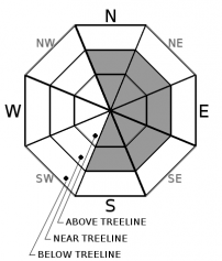
A couple inches of dust on crust has fallen overnight. Expect LOW avalanche danger for the day -- below, near and above treeline.
Any avalanche(s) will not be large enough to bury a person, but nonetheless, keep an eye out for wind blowing snow onto leeward, easterly aspects. Small wind slabs may be capable of causing a slip/fall onto icy surfaces in steep terrain. Self-arrest on existing ice layers is difficult.


Avalanche Problem 1: Wind Slab
-
Character ?

-
Aspect/Elevation ?
-
Likelihood ?CertainVery LikelyLikelyPossible
 Unlikely
 -
Size ?HistoricVery LargeLargeSmall

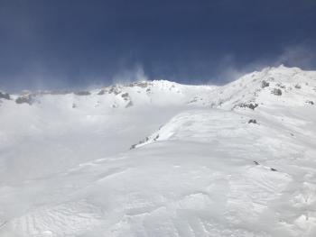
Sadly, only 1 to 2 inches of snow verified out of the storm last night. This morning, precipitation will cease; northwesterly wind will go on. Exposed terrain near/above treeline has presumably remained scoured and significant wind loading of concern is unlikely. More protected areas near/below treeline may see minor wind loading, but an avalanche of significant size, large enough to bury a person, is also unlikely.
Use standard wind slab precautions near and above treeline today. Watch for:
- Wind blowing snow and note where it's headed...probably off to the east!
- Scoured, icy surfaces immediately followed by wind pillows, hard wind slabs, fresh cornices
- Remember, even small avalanches in complex terrain or with terrain traps below can have increased consequences
UPDATE (9:45 am): A last minute spurt of snow was recorded at the Old Ski Bowl weather station after publication of today's forecast. Observed is up to 6 inches of new snow overnight. Avalanche danger is expected to stay the same and continue to watch for wind blowing snow and small wind slabs in isolated areas.
Forecast Discussion
We've got a smorgasbord of existing snow surfaces out there, all trending on the nasty side of things. A skiff of fresh snow will help a bit. Chilly temps, windy conditions and icy surfaces will make it difficult for the new snow to bond to the old snow, especially in steeper terrain near and above treeline. Low angle gullies might be the ticket for enjoyable sliding and riding recreation. Continue to watch out for very slick and icy surfaces along ridgelines and moraine tops.
This Saturday is the MSAC's annual motorized specific, avalanche awareness and companion rescue workshop. Meet at the Forest Service ranger station in Mount Shasta at 9am, 204 W Alma Street. No sign up necessary. Click HERE for more info. Check out the teaser below!
Knowledge Is Powder - Snowmobiling from Trent Meisenheimer on Vimeo.
Recent Observations
- 1.5 inches of new snow overnight
- In the last 24 hours, chilly temperatures have ranged from 20 to 23°F at treeline.
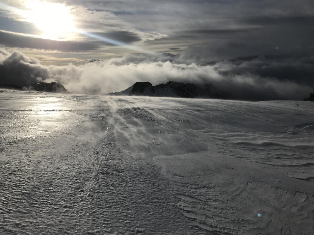
- West to northwest winds have been moderate, averaging 15 mi/hr and maxing out at 31 mi/hr.
- Snow surfaces cover a wide range of less than ideal riding conditions. An inch or two of fresh snow this morning will blanket various breakable and supportable crusts, scoured icy layers and 4-6 inches of lower density snow below treeline.
- Freezing fog yesterday morning created a light crust in some areas below treeline.
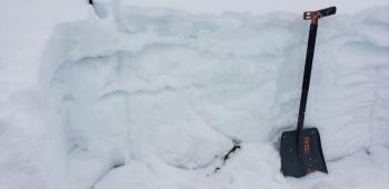
- Near and above treeline, wind has scoured much of the snowpack down to the 12/19 icy, crust layer that is breakable by boots, supportable on skis.
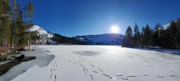
- Castle Lake is frozen. A widespread crust dominates the snow surface on all peaks. Snow depth is 25 in (65 cm).
- The existing snowpack is stable. No sign(s) of instabilities have been observed or reported.
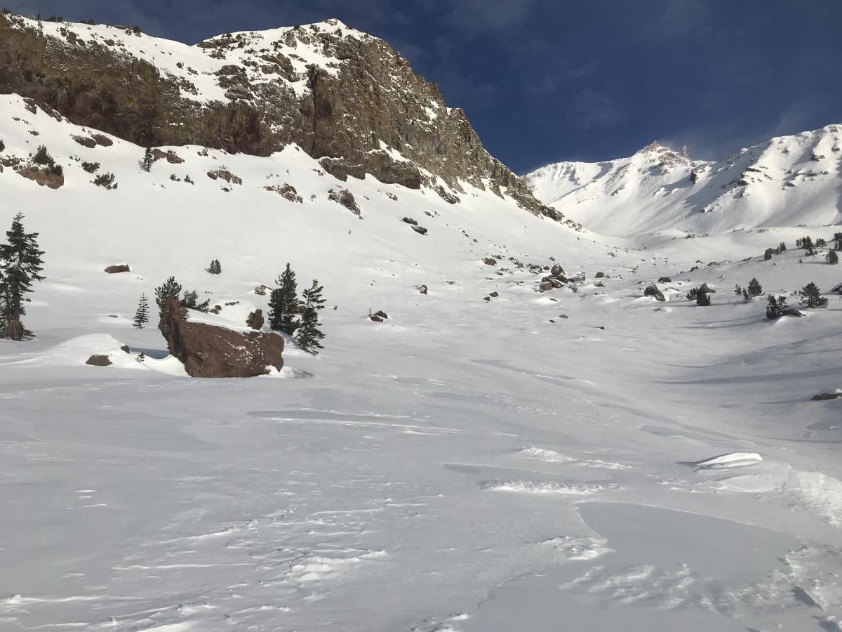
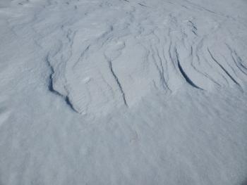
Above and Below: Typical snow surfaces near and above treeline on Mount Shasta. Photo on 1.8.20
Weather and Current Conditions
Weather Summary
Last night's fleeting storm will exit the area this morning. Mostly clear skies will follow for today and tomorrow. Expect light wind below treeline and moderate wind speeds near and above treeline out of the north/northwest. Temperatures will warm a few degrees tomorrow before another cold air mass moves in for the weekend.
Southerly winds will signify the next system moving in Friday evening. While another lackluster storm, we should see a tenth of an inch of water, which could mean an inch or two of snow on the mountain Friday night. Snow levels are near 3,000 feet.
Sunday through Wednesday, a series of systems originating from the Gulf of Alaska will drop into our forecast area bringing unsettled winter weather and low snow levels. We should see a significant amount of snow in this time period, taking a welcomed bite out of the below normal precipitation deficit for the season.
24 Hour Weather Station Data @ 4:00 AM
| Weather Station | Temp (°F) | Wind (mi/hr) | Snow (in) | Comments | ||||||||
|---|---|---|---|---|---|---|---|---|---|---|---|---|
| Cur | Min | Max | Avg | Avg | Max Gust | Dir | Depth | New | Water Equivalent | Settlement | ||
| Mt. Shasta City (3540 ft) | 34 | 24 | 46 | 36 | 1 | N | ||||||
| Sand Flat (6750 ft) | 25 | 24 | 28 | 26 | 41 | 4 | .3 | 0 | ||||
| Ski Bowl (7600 ft) | 20.5 | 20 | 23.5 | 21.5 | 48 | 6 | .39 | 0 | ||||
| Gray Butte (8000 ft) | 19.5 | 17.5 | 22.5 | 20 | 15 | 31 | WNW | |||||
| Castle Lake (5870 ft) | down | |||||||||||
| Mount Eddy (6509 ft) | 24 | 22 | 29 | 25 | 1 | 7 | SSE | 33.9 | .5 | 0 | ||
| Ash Creek Bowl (7250 ft) | down | |||||||||||
| Ash Creek Ridge (7895 ft) | down |
Two Day Mountain Weather Forecast
Produced in partnership with the Medford NWS
| For 7000 ft to 9000 ft | |||
|---|---|---|---|
|
Thursday (4 a.m. to 10 p.m.) |
Thursday Night (10 p.m. to 4 a.m.) |
Friday (4 a.m. to 10 p.m.) |
|
| Weather | Cloudy with snow showers likely before 10am, then becoming mostly sunny, blustery. Snow levels near 3,000 to 3,500 feet. | Partly cloudy, blustery. | Increasing clouds with a 20% chance of snow after 10am. Snow levels near 3,500 feet. |
| Temperature (°F) | 27 | 24 | 36 |
| Wind (mi/hr) | Northwest 10-15 | North 10-15 | Southwest 5-10 |
| Precipitation SWE / Snowfall (in) | 0.07 / 0-1 | 0.00 / 0 | 0.01 / 0 |
| For 9000 ft to 11000 ft | |||
| Thursday | Thursday Night | Friday | |
| Weather | Cloudy, snow showers likely before 10 am. Gradually becoming mostly sunny. Windy, wind chill as low as -18 F. | Partly cloudy, windy. Wind chill values as low as -6 F. | Increasing clouds, windy. Wind chill values as low as -15 F. A 20% chance of snow after 10 am. |
| Temperature (°F) | 20 | 20 | 26 |
| Wind (mi/hr) | Northwest 20-30 | North 40-50 | Northwest 30-40 |
| Precipitation SWE / Snowfall (in) | 0.07 / 0-1 | 0.00 / 0 | 0.01 / 0 |
Season Precipitation for Mount Shasta City
| Period | Measured (in) | Normal (in) | Percent of Normal (%) |
|---|---|---|---|
| From Oct 1, 2025 (the wet season) | 9.23 | 17.10 | 54 |
| Month to Date (since Jul 1, 2026) | 0.30 | 1.89 | 16 |
| Year to Date (since Jan 1, 2026) | 0.30 | 1.89 | 16 |

