

You are here
Avalanche Forecast for 2020-03-23 06:50
- EXPIRED ON March 24, 2020 @ 6:50 amPublished on March 23, 2020 @ 6:50 am
- Issued by Ryan Sorenson - Mount Shasta Avalanche Center
Bottom Line
The avalanche danger is LOW. Anticipate changing conditions as scattered snow showers begin to move into the area along with increasing south and west winds. Watch for isolated wind slabs above treeline. Less than an inch of new snow will accumulate today. More snow and wind are forecast tomorrow.


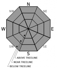
Avalanche Problem 1: Normal Caution
-
Character ?

-
Aspect/Elevation ?
-
Likelihood ?CertainVery LikelyLikelyPossible
 Unlikely
 -
Size ?HistoricVery LargeLargeSmall

Scattered snow showers will begin to move into the area along with increasing south and west winds. Less than an inch of new snow is expected to accumulate today. Anticipate changing conditions as new snow and W/SW wind impacts the backcountry over the next few days.
Exercise normal caution:
- Watch for small, isolated wind slabs especially late tonight as snow showers increase.
- Bring and always be prepared to use your avalanche rescue tools.
- Practice safe travel techniques when traveling in or near avalanche terrain.
- An ice axe, crampons and HELMET is advised above 10,000 feet.
Recent Observations
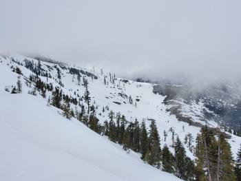
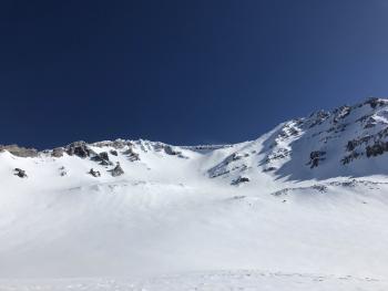
In the last 24 hours on Mount Shasta, near treeline temperatures ranged from 27 to 39 degrees. Mostly calm to light winds have occurred, but they look to be increasing this morning. Currently (0600), the wind is moderate out of the west/northwest at 8,000 feet (Gray Butte weather station). The Old Ski Bowl station has recorded no new snow.
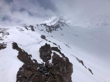
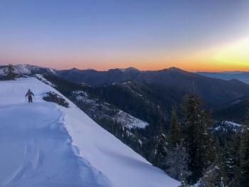
On a tour up to Helen Lake yesterday, a mixed bag of conditions was encountered. Layers of clouds would move in and out. Conditions would quickly change as the sun would peek through, causing it to become balmy and warm. Othertimes, periods of building clouds caused low visibility and cooler temperatures. Snow surfaces had a little bit of everything. Cold, hot, icy, sun crusts, sticky, you name it, it was out there. An average snow depth of 72 inches (185 cm) was measured at Lake Helen (10,400 feet).
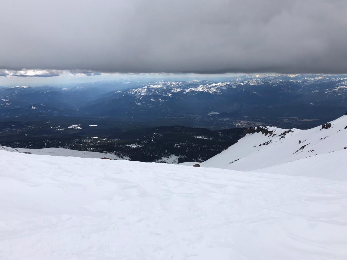
Looking down Avalanche Gulch from Helen Lake 03.22.2020 [Photo: R Sorenson]
Weather and Current Conditions
Weather Summary
The possibility of scattered snow showers will increase as a small storm moves in. Over the next 48 hours, models show slightly less than a half-inch of water with snow levels near Mount Shasta City (~3,000 feet). This will equate to approximately six inches of total snow accumulation, with the bulk of the snow expected to arrive tomorrow afternoon.
South to southwest winds looks to be light with moderate gusts below treeline. Upper elevations will receive strong to gale force winds. The temperature will drop as this storm pushes in. Snow levels will start around 5,000 feet this morning and dropping to 3,700 feet tonight.
24 Hour Weather Station Data @ 3:00 AM
| Weather Station | Temp (°F) | Wind (mi/hr) | Snow (in) | Comments | ||||||||
|---|---|---|---|---|---|---|---|---|---|---|---|---|
| Cur | Min | Max | Avg | Avg | Max Gust | Dir | Depth | New | Water Equivalent | Settlement | ||
| Mt. Shasta City (3540 ft) | 34 | 29 | 62 | 45.5 | 0 | N | ||||||
| Sand Flat (6750 ft) | 28 | 21 | 43 | 32 | 43 | 0 | 0 | 0 | ||||
| Ski Bowl (7600 ft) | 29.5 | 27 | 39 | 32 | 68.7 | 0 | 0 | 0.3 | ||||
| Gray Butte (8000 ft) | 27.5 | 27 | 38.5 | 32 | 6 | 25 | WNW | |||||
| Castle Lake (5870 ft) | 33.5 | 32.5 | 55.5 | 41.5 | 36.2 | 0 | 1.1 | |||||
| Mount Eddy (6509 ft) | 32.5 | 25.5 | 44 | 36 | 2 | 8 | WSW | 52.6 | 0 | 0 | ||
| Ash Creek Bowl (7250 ft) | down | |||||||||||
| Ash Creek Ridge (7895 ft) | down |
Two Day Mountain Weather Forecast
Produced in partnership with the Medford NWS
| For 7000 ft to 9000 ft | |||
|---|---|---|---|
|
Monday (4 a.m. to 10 p.m.) |
Monday Night (10 p.m. to 4 a.m.) |
Tuesday (4 a.m. to 10 p.m.) |
|
| Weather | Mostly cloudy. Chance of snow in the morning, then snow likely in the afternoon. A 40 percent chance of snow. Snow level near 5,000 feet. | Mostly cloudy. Snow showers likely. A 50 percent chance of snow showers. Snow level near 3,700 feet. | Snow showers. Snow levels near 3,000 feet or lower. |
| Temperature (°F) | 37 | 26 | 28 |
| Wind (mi/hr) | Southwest 10-15 | Southwest 10-15 | Southwest 5-10 |
| Precipitation SWE / Snowfall (in) | 0.01 / 0-1 | 0.02 / 0-1 | 0.37 / 2-4 |
| For 9000 ft to 11000 ft | |||
| Monday | Monday Night | Tuesday | |
| Weather | Chance of snow in the morning, then snow likely in the afternoon. Strong gusty winds. | Snow showers likely. | Snow showers. |
| Temperature (°F) | 21 | 8 | 10 |
| Wind (mi/hr) | Southwest 35-40 | Southwest 40-45 | Southwest 30-35 |
| Precipitation SWE / Snowfall (in) | 0.01 / 0-1 | 0.02 / 0-1 | 0.37 / 2-5 |
Season Precipitation for Mount Shasta City
| Period | Measured (in) | Normal (in) | Percent of Normal (%) |
|---|---|---|---|
| From Oct 1, 2025 (the wet season) | 14.85 | 34.20 | 43 |
| Month to Date (since Jun 1, 2026) | 1.95 | 4.70 | 41 |
| Year to Date (since Jan 1, 2026) | 5.92 | 18.99 | 31 |

