

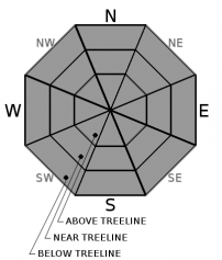
You are here
Avalanche Forecast for 2020-03-27 06:36
- EXPIRED ON March 28, 2020 @ 6:36 amPublished on March 27, 2020 @ 6:36 am
- Issued by Nick Meyers - Shasta-Trinity National Forest
Bottom Line
Avalanche danger is LOW and normal caution is advised. Overall, safe avalanche conditions exist, but continue to be cautious of small, isolated wind slabs in steep, leeward terrain. Expect increasing clouds and blustery conditions near and above treeline. Some low density snow remains available for wind transport. Light snow showers will begin tonight and into the weekend.


Avalanche Problem 1: Normal Caution
-
Character ?

-
Aspect/Elevation ?
-
Likelihood ?CertainVery LikelyLikelyPossible
 Unlikely
 -
Size ?HistoricVery LargeLargeSmall

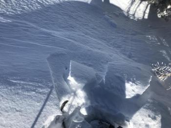
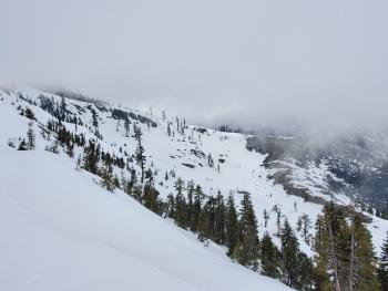
Avalanche danger is LOW. Low density snow that did not form a sun crust yesterday may still be available for wind transport. Pay attention to localized wind and look for blowing snow. It won't be impossible to come across existing small, isolated wind slabs near the tops of bowls and ridgelines. They'll be lens shaped and crack under your feet. Test wind slabs on small slopes or rollovers with no consequence.
Forecast Discussion
It's that time of year when the weather can change drastically in a short period of time. In the recent weeks, we've seen sun and snow simultaneously! Pay attention to changing conditions and always look for the 5 red flags of avalanche danger:
1-Recent Avalanches / 2-Heavy Snow / 3-Wind Blowing Snow / 4-Shooting Cracks/Whumphing / 5-Rapid Warming
Recent Observations
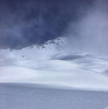
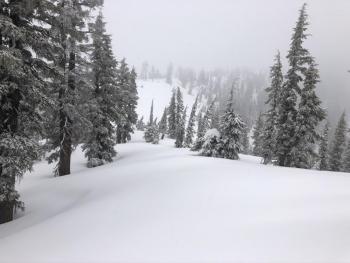
In the last 24 hours, we've received no new snow. Winds have been variable and light. Temperatures ranged from 11 to 30 degrees at treeline. Yesterday was a chilly day with full sun, isolated clouds and calm wind. A uniform, 3 to 6 inches (15cm) of low density snow rests on top of old melt/freeze crusts. Below treeline, the snowpack has been unaffected by wind and storm slab properties are poor. Near treeline is transitional. Above treeline, some wind effect is noticeable with light texturing of snowpack from northwesterlies...though generally speaking winds have been remarkably light over the past several days. Small wind slabs were easily triggered on test slopes, fracturing withing the new snow. Lack of sustained winds has kept slab size small and not big enough to bury a person. Small drifts observed up to 1 foot deep. Widespread surface hoar has developed on northerly aspects near and below treeline. A full day of sun yesterday helped break down some surface hoar as well as likely introduced a sun crust to some solar aspects. Despite recent snow, shallow buried obstacles still exist.
Weather and Current Conditions
Weather Summary
Gradually increasing clouds today will usher in showery conditions for the weekend. Snow levels should hover in the 4,000 to 4,500 foot range. Upwards of .42 inches of water is forecast, which could mean 3-6 inches of fresh snow by next week. The heaviest precipitation period will be mid-day Saturday, though expect showers all weekend. Temperatures will stay relatively chilly. Winds look mellow below treeline and gusty near and above treeline out of the west/southwest.
24 Hour Weather Station Data @ 4:00 AM
| Weather Station | Temp (°F) | Wind (mi/hr) | Snow (in) | Comments | ||||||||
|---|---|---|---|---|---|---|---|---|---|---|---|---|
| Cur | Min | Max | Avg | Avg | Max Gust | Dir | Depth | New | Water Equivalent | Settlement | ||
| Mt. Shasta City (3540 ft) | 29 | 28 | 49 | 37 | 2 | |||||||
| Sand Flat (6750 ft) | 23 | 7 | 32 | 22 | 40 | 0 | 0 | 4 | ||||
| Ski Bowl (7600 ft) | 20.5 | 11 | 30.5 | 21.5 | 72.3 | 0 | 0 | 1.1 | ||||
| Gray Butte (8000 ft) | 21.5 | 12 | 26.5 | 21.5 | 5 | 25 | NW | |||||
| Castle Lake (5870 ft) | 24 | 17 | 39.5 | 28.5 | 37 | 0 | 0 | |||||
| Mount Eddy (6509 ft) | 18.5 | 15 | 31 | 23.5 | 2 | 7 | WSW | 58.5 | 0 | 2 | ||
| Ash Creek Bowl (7250 ft) | down | |||||||||||
| Ash Creek Ridge (7895 ft) | down |
Two Day Mountain Weather Forecast
Produced in partnership with the Medford NWS
| For 7000 ft to 9000 ft | |||
|---|---|---|---|
|
Friday (4 a.m. to 10 p.m.) |
Friday Night (10 p.m. to 4 a.m.) |
Saturday (4 a.m. to 10 p.m.) |
|
| Weather | Partly cloudy this morning then becoming mostly cloudy. | Mostly cloudy. Snow showers. Snow level near 4,500 feet | Snow showers, snow level near 4,200 feet. |
| Temperature (°F) | 33 | 26 | 30 |
| Wind (mi/hr) | Northwest 0-5 | Southwest 5-10 | South 5-10 |
| Precipitation SWE / Snowfall (in) | 0.00 / 0 | 0.07 / 1-3 | 0.12 / 1-3 |
| For 9000 ft to 11000 ft | |||
| Friday | Friday Night | Saturday | |
| Weather | Partly cloudy becoming mostly cloudy, blustery. | Mostly cloudy, snow showers. | Snow showers, cloudy, breezy. |
| Temperature (°F) | 13 | 13 | 14 |
| Wind (mi/hr) | West 10-15 | West 10-15 | Southwest 15-20 |
| Precipitation SWE / Snowfall (in) | 0.00 / 0 | 0.07 / 1-3 | 0.12 / 1-3 |
Season Precipitation for Mount Shasta City
| Period | Measured (in) | Normal (in) | Percent of Normal (%) |
|---|---|---|---|
| From Oct 1, 2025 (the wet season) | 14.95 | 34.79 | 43 |
| Month to Date (since Jun 1, 2026) | 2.05 | 5.29 | 39 |
| Year to Date (since Jan 1, 2026) | 6.02 | 19.58 | 31 |

