

You are here
Avalanche Forecast for 2020-12-09 06:30
- EXPIRED ON December 10, 2020 @ 6:30 amPublished on December 9, 2020 @ 6:30 am
- Issued by Aaron Beverly - Mount Shasta Avalanche Center
Bottom Line
Snow avalanches are extremely unlikely, if not impossible, due to the thin snowpack. The icy snowpack, encasing numerous rocks, makes climbing Mount Shasta ill-advised. A series of fronts will bring wet weather Friday night through next week.


Avalanche Problem 1: Normal Caution
-
Character ?

-
Aspect/Elevation ?
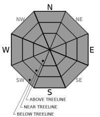
-
Likelihood ?CertainVery LikelyLikelyPossible
 Unlikely
Normal caution is advised. Use safe travel techniques and bring your beacon, shovel and probe. Practice your rescue skills. Get ready for the coming snow.
Avalanches are extremely unlikely, if not impossible, due to a thin snowpack. Finding consistent snow is challenging. Watch out for obstacles above and below the snow surface. They are numerous.
Forecast Discussion
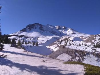
Climbing Mount Shasta is not advised at this time. At high elevations, you'll find the snowpack to be thin, firm, and icy. A fall on a steep slope would lead to a long ride into a mine field of rocks.
Hear alot about La Niña? Well she is here and there is a 95% chance that she will hangout through March according to the NWS Climate Prediction Center. This phenomon affects our weather and snowpack. Here is an article explaining what it is and how it may impact our winter:
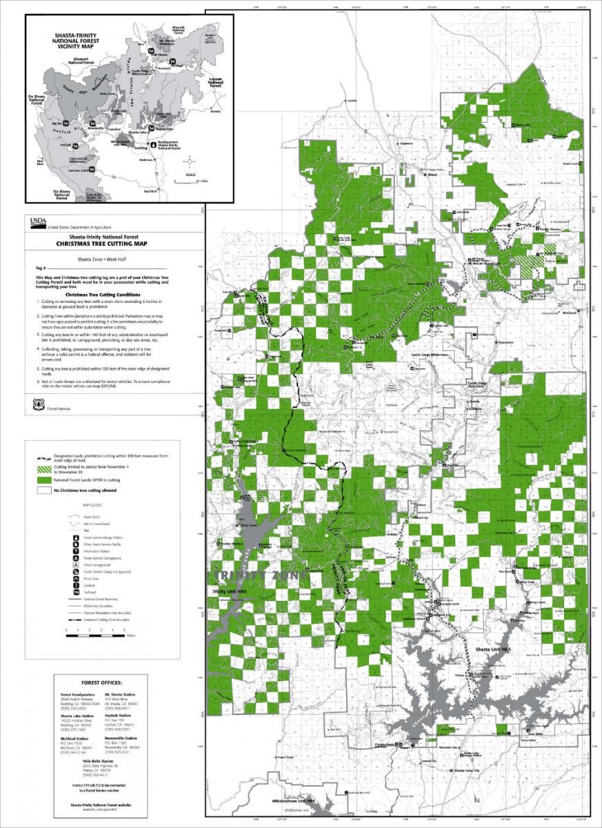
Christmas Tree cutting is not allowed around Bunny Flat. Below is the map showing permissible areas for cutting. Please be informed.
Recent Observations
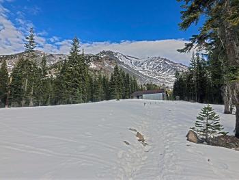
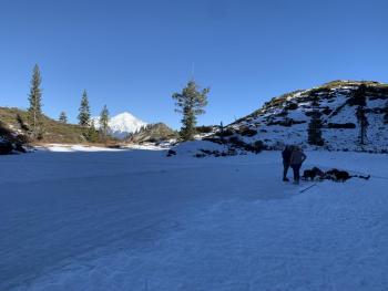
At 7,600 ft on Mount Shasta, you'll find around a 12 inches of snow left over from our November 17th storm.. Temperatures in the last 24 hours have been above freezing with a high of 55 degrees. There are more boulders than snow above treeline though some creative skiers have found paths through the maze. Ski gently as rocks lurk beneath the surface.
Similar conditions exist out at Ash Creek Butte with sheltered areas holding around 14 inches of snow. Once you find continuous snow, you'll find the road out to the bowl severely rutted by 4x4 activity. Its not worth bringing your snowmobile for. There is no snow at Pilgrim Creek Snowmobile Park.
There is no usable snowpack at Castle Lake and the lake is not frozen.
Weather and Current Conditions
Weather Summary
Several fronts will move through the area over the next several days. Though we may see a few flurries tomorrow afternoon, most precipitation from these fronts will begin Friday night. The good news is that we could see up to 7 inches of snow by Sunday. The bad news is, although snow levels will start near town, they will spike Saturday to over 7,000 ft. However, snow levels will drop again Sunday when the bulk of the precipitation is expected. If the timing is right, we may get a nice dose of snow over the weekend.
Today and tomorrow expect partly sunny weather, dropping temperatures, and moderate winds.
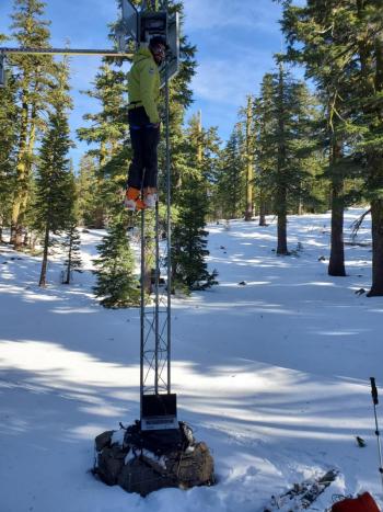
24 Hour Weather Station Data @ 5:00 AM
| Weather Station | Temp (°F) | Wind (mi/hr) | Snow (in) | Comments | ||||||||
|---|---|---|---|---|---|---|---|---|---|---|---|---|
| Cur | Min | Max | Avg | Avg | Max Gust | Dir | Depth | New | Water Equivalent | Settlement | ||
| Mt. Shasta City (3540 ft) | 29 | 27 | 56 | 36.5 | 2 | N | ||||||
| Sand Flat (6750 ft) | 34 | 32 | 56 | 41 | 8 | 0 | 0 | 1 | ||||
| Ski Bowl (7600 ft) | 35.5 | 35.5 | 56.5 | 47 | 12.7 | 0 | 0 | 0 | ||||
| Gray Butte (8000 ft) | 37.5 | 37.5 | 55.5 | 48.5 | 12 | 37 | W | |||||
| Castle Lake (5870 ft) | 40 | 39 | 54 | 47.5 | 2.4 | 0 | 0.4 | |||||
| Mount Eddy (6509 ft) | 38.5 | 37.5 | 56 | 44.5 | 2 | 5 | WSW | 7.7 | 0 | 0.5 | ||
| Ash Creek Bowl (7250 ft) | ||||||||||||
| Ash Creek Ridge (7895 ft) |
Two Day Mountain Weather Forecast
Produced in partnership with the Medford NWS
| For 7000 ft to 9000 ft | |||
|---|---|---|---|
|
Wednesday (4 a.m. to 10 p.m.) |
Wednesday Night (10 p.m. to 4 a.m.) |
Thursday (4 a.m. to 10 p.m.) |
|
| Weather | Partly sunny. | Mostly cloudy, becoming mostly clear. | Isolated snow showers after 4 p.m. Mostly sunny. Chance of precipitation is 10%. |
| Temperature (°F) | 40 | 26 | 36 |
| Wind (mi/hr) | North 5-10 | Northeast 5-10 | North 5-10 |
| Precipitation SWE / Snowfall (in) | 0.00 / 0 | 0.00 / 0 | 0.00 / 0 |
| For 9000 ft to 11000 ft | |||
| Wednesday | Wednesday Night | Thursday | |
| Weather | Partly sunny. | Partly cloudy. | Mostly sunny. Isolated snow showers after 4 p.m. Decreasing temperatures. Blustery. Chance of precipitation is 10%. |
| Temperature (°F) | 31 | 27 | 28 |
| Wind (mi/hr) | Northwest 15-20 | Northeast 10-15 | Northwest 15-20 |
| Precipitation SWE / Snowfall (in) | 0.00 / 0 | 0.00 / 0 | 0.00 / 0 |
Season Precipitation for Mount Shasta City
| Period | Measured (in) | Normal (in) | Percent of Normal (%) |
|---|---|---|---|
| From Oct 1, 2025 (the wet season) | 1.70 | 9.21 | 18 |
| Month to Date (since Jul 1, 2026) | T | 1.85 | 0 |
| Year to Date (since Jan 1, 2026) | 14.61 | 37.21 | 39 |

