

You are here
Avalanche Forecast for 2020-12-10 06:17
- EXPIRED ON December 11, 2020 @ 6:17 amPublished on December 10, 2020 @ 6:17 am
- Issued by Nick Meyers - Shasta-Trinity National Forest
Bottom Line
LOW avalanche danger continues with normal caution advised in the winter backcountry. Today's biggest hazard(s) are rocks, trees and brush. Winter weather will begin this weekend and bring a period of rain, mountain snow and windy conditions at times. Get ready!


Avalanche Problem 1: Normal Caution
-
Character ?

-
Aspect/Elevation ?
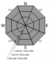
-
Likelihood ?CertainVery LikelyLikelyPossible
 Unlikely
Normal caution is advised for avalanches, but extra caution is advised for rocks, brush and small trees that are exposed or barely covered. Snow conditions are variable: wind scoured, soft(ish) and unconsolidated below treeline in wind protected areas and a variety of crusts throughout. Use safe travel techniques and bring your beacon, shovel and probe. Practice your rescue skills. Get ready for the coming snow.
Forecast Discussion
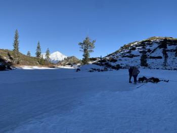
Climbing Mount Shasta is NOT advised at this time. Be prepared for FULL winter conditions, short days, bitter cold and extreme wind. At high elevations, you'll find the snowpack to be thin, firm, and icy. A fall on a steep slope would lead to a long ride into a minefield of rocks.
La Niña? She is a knockin' and there is a 95% chance that she will hangout through March according to the NWS Climate Prediction Center. This phenomenon affects our weather and snowpack. Here is an article explaining what it is and how it may impact our winter:
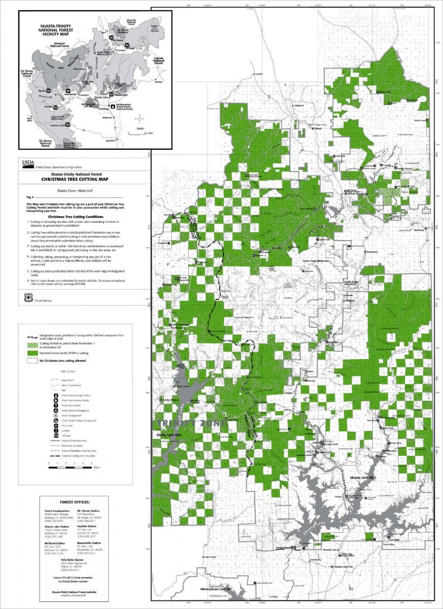
Christmas Tree cutting is not allowed around Bunny Flat (yes, this has been a problem this year ![]() ). Below is the map showing permissible areas for cutting. Please be informed.
). Below is the map showing permissible areas for cutting. Please be informed.
Recent Observations
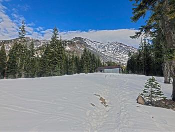
Near treeline on the mountain, an average of 12 inches of snow remains from the November 17th storm. Many continental snowpacks (Utah/Colorado) are hosting thick layers of sugary, faceted snow at ground level...a horrible setup for additional snow load. The faceting process, spurred by mostly clear skies, long cold nights and low sun angles, has created a few areas with a similar setup of weak, sugary snow in some areas within our forecast area. The concern is that this weak snow will not be strong enough to support much additional snow load. As storms begin to pile onto this weak snow, it could become a buried weak layer in the future.
For now, rocks/brush/trees still dominate our classic avalanche paths and will help with anchoring of any new snow. It will take a couple feet of snow before we get smooth bed surfaces. Avalanche danger will be more of a concern at that time. Wind has scoured areas near and above treeline down to a variety of firm crusts. When we start to receive new snow, hard obstacles will be hidden perfectly within the enticing powder. Until the snow sets up, I wouldn't be blasting turns without caution for big, fat, healthy snow sharks.
Weather and Current Conditions
Weather Summary
If you've been knocking on the storm doors, Mother Nature is about to answer. The overall weather pattern for the next couple of weeks will be unsettled with a series of frontal systems expected to rumble through the Pacific Northwest. Fronts will bring periods of rain, mountain snow and gusty wind at times. Confidence is high for above normal precipitation through this period due to a progressive and active westerly jet that will direct weather into our area.
The upper level ridge that has been bringing us stable conditions will break down tonight. This first system won't be hard hitting, but will commence a stormy period leading up to, we hope, a white Christmas! For this first round, areas to the west will see higher precipitation totals. We might see a trace of snow tonight, but Friday night/Saturday will host a more significant system. Stay tuned for the latest and, welcome to winter. ![]()
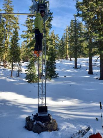
We are extremely happy to report that ALL weather stations are up and running. It was a huge project to completely renovate our weather station telemetry and system. Cheers!
24 Hour Weather Station Data @ 1:00 PM
| Weather Station | Temp (°F) | Wind (mi/hr) | Snow (in) | Comments | ||||||||
|---|---|---|---|---|---|---|---|---|---|---|---|---|
| Cur | Min | Max | Avg | Avg | Max Gust | Dir | Depth | New | Water Equivalent | Settlement | ||
| Mt. Shasta City (3540 ft) | 29 | 27 | 56 | 36.5 | 2 | N | ||||||
| Sand Flat (6750 ft) | 23 | 23 | 40 | 31 | 8 | 0 | 0 | 0 | ||||
| Ski Bowl (7600 ft) | 38.5 | 31 | 39 | 36.5 | 12 | 0 | 0 | 0 | ||||
| Gray Butte (8000 ft) | 35 | 33.5 | 37.5 | 35 | 12 | 43 | ENE | |||||
| Castle Lake (5870 ft) | 29 | 28.5 | 40 | 33.5 | 2.4 | 0 | 0 | |||||
| Mount Eddy (6509 ft) | 27 | 26 | 38.5 | 33 | 2 | 7 | SSW | 7.7 | 0 | 0 | ||
| Ash Creek Bowl (7250 ft) | 27.5 | 26.5 | 35.5 | 30 | 14.2 | 0 | 0 | |||||
| Ash Creek Ridge (7895 ft) | 28.5 | 22 | 31.5 | 27 |
Two Day Mountain Weather Forecast
Produced in partnership with the Medford NWS
| For 7000 ft to 9000 ft | |||
|---|---|---|---|
|
Thursday (4 a.m. to 10 p.m.) |
Thursday Night (10 p.m. to 4 a.m.) |
Friday (4 a.m. to 10 p.m.) |
|
| Weather | Mostly sunny this morning, then partly cloudy with a slight chance of snow showers this afternoon after 4p.m. Snow levels near town. | Partly cloudy with 20% chance of snow showers in the evening, then mostly cloudy. Snow level near town. Blustery wind on the mountain. | A 40% chance of snow after 10a.m. Partly sunny. Snow level near town. |
| Temperature (°F) | 38 | 16 | 31 |
| Wind (mi/hr) | Northeast 5-10 | Northwest 10-20 | Northeast to south 5-10 |
| Precipitation SWE / Snowfall (in) | 0.00 / 0 | 0.00 / 0 | 0.34 / 1-2 |
| For 9000 ft to 11000 ft | |||
| Thursday | Thursday Night | Friday | |
| Weather | Mostly sunny and windy. Temperatures falling. Chance of snow after 4p.m. | Chance of snow, partly cloudy, windy. | A 50% chance of snow after 10a.m. Partly sunny, windy. |
| Temperature (°F) | 23 | 15 | 20 |
| Wind (mi/hr) | Northwest 15-25 | Northwest 35-45 | West 35-45 |
| Precipitation SWE / Snowfall (in) | 0.00 / 0 | 0.00 / 0 | 0.34 / 1-3 |
Season Precipitation for Mount Shasta City
| Period | Measured (in) | Normal (in) | Percent of Normal (%) |
|---|---|---|---|
| From Oct 1, 2025 (the wet season) | 1.70 | 9.45 | 18 |
| Month to Date (since Jul 1, 2026) | 0 | 2.09 | 0 |
| Year to Date (since Jan 1, 2026) | 14.61 | 37.45 | 39 |

