

You are here
Avalanche Forecast for 2021-02-21 06:30
- EXPIRED ON February 22, 2021 @ 6:30 amPublished on February 21, 2021 @ 6:30 am
- Issued by Ryan Sorenson - Mount Shasta Avalanche Center
Bottom Line
Lingering wind slabs will remain the main concern today. Productive light to moderate wind speeds and blowing snow were observed yesterday. Continue to watch out for potentially unstable slabs of wind drifted snow. While warm temperatures have allowed the sensitivity to trigger to improve, human-triggered wind slab avalanches remain possible on steep slopes near and above treeline. Colder shaded aspects or slopes at higher elevations are most suspect.


Avalanche Problem 1: Wind Slab
-
Character ?

-
Aspect/Elevation ?
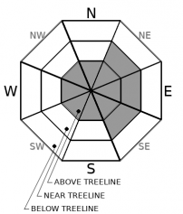
-
Likelihood ?CertainVery LikelyLikelyPossible
 Unlikely
 -
Size ?HistoricVery LargeLargeSmall

Productive winds yesterday were actively loading NE-E-SE aspects above treeline. The sun came out, and the warming temperatures have allowed the snowpack to settle and consolidate some. While wind slab sensitivity to trigger has likely improved, lingering wind slabs could still lurk in steep terrain. Colder shaded slopes or slopes at higher elevations are most suspect. Large and potentially fragile cornices likely remain along steep ridgelines. These should be approached with caution.
Forecast Discussion
Keep your avalanche rescue skills fresh by practicing companion rescue. This video explains the best way to perform an avalanche rescue:
Recent Observations
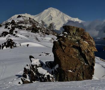
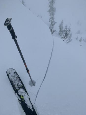
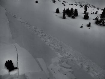
The clouds broke early yesterday morning and gave way to an exquisite day. Lingering misty clouds did little to block the bright blue sky above. There were some notable northerly winds, especially above treeline, though it wasn't the widespread scouring type that has obliterated our snowpack this winter. Winds were funneling down the gullies causing variable wind directions and speeds for lower elevations. We observed light to moderate winds up to 9,000 on a tour up Lower Casaval Ridge. Snow surfaces were soft and smooth below and near treeline, but a transition to slightly wind-affected surfaces was noted above treeline. Some cracking and blocking were seen on the skin track as we traversed a southeast aspect. A pit dug on the southeast flank of Casaval Ridge, near treeline, measured 8 inches (20 cm) of fist hard snow from the series of storms on Thursday and Friday (2/18 and 2/19). This sits atop an inch thick (5 cm) crust. Column tests produced planar results with moderate force within the new snow and on a density change down 23 inches (60 cm) but did not propagate in extended column tests.

Weather and Current Conditions
Weather Summary
The tail of a storm is skipping by us to the north. Partly cloudy skies will trap heat in allowing temperatures to climb throughout the day. High temperatures will reach the low to mid 30's F. No precipitation is expected. Northerly flow has set in, though wind speeds will remain light to moderate for the next few days. Expect clearing skies late this evening. Temperatures will climb even higher tomorrow. Colder air will filter back in mid-week. We will transition into a cooler and active weather pattern after the next system arrives sometime Thursday.
24 Hour Weather Station Data @ 6:00 AM
| Weather Station | Temp (°F) | Wind (mi/hr) | Snow (in) | Comments | ||||||||
|---|---|---|---|---|---|---|---|---|---|---|---|---|
| Cur | Min | Max | Avg | Avg | Max Gust | Dir | Depth | New | Water Equivalent | Settlement | ||
| Mt. Shasta City (3540 ft) | 33 | 31 | 45 | 35.5 | 4 | |||||||
| Sand Flat (6750 ft) | 16 | 16 | 30 | 22 | 0 | 0 | 0 | 0 | ||||
| Ski Bowl (7600 ft) | 16 | 14 | 26.5 | 20 | 83.5 | 0 | 0 | 1.9 | ||||
| Gray Butte (8000 ft) | 17.5 | 14 | 24.5 | 19 | 5 | 25 | ESE | |||||
| Castle Lake (5870 ft) | 23 | 20.5 | 30.5 | 24.5 | 66.8 | 0 | 2.9 | |||||
| Mount Eddy (6509 ft) | 22.5 | 20.5 | 26.5 | 23 | 3 | 7 | SE | 63 | 1 | 0 | ||
| Ash Creek Bowl (7250 ft) | 18 | 16 | 24 | 19.5 | 60.6 | 0 | 0.5 | |||||
| Ash Creek Ridge (7895 ft) | 14.5 | 13.5 | 19.5 | 16 | 0 | 0 | rime |
Two Day Mountain Weather Forecast
Produced in partnership with the Medford NWS
| For 7000 ft to 9000 ft | |||
|---|---|---|---|
|
Sunday (4 a.m. to 10 p.m.) |
Sunday Night (10 p.m. to 4 a.m.) |
Monday (4 a.m. to 10 p.m.) |
|
| Weather | Partly cloudy. | Partly cloudy in the evening, then clearing. | Partly cloudy. |
| Temperature (°F) | 37 | 29 | 46 |
| Wind (mi/hr) | North 5-10 | North 5-10 | North 5-10 |
| Precipitation SWE / Snowfall (in) | 0.00 / 0 | 0.00 / 0 | 0.00 / 0 |
| For 9000 ft to 11000 ft | |||
| Sunday | Sunday Night | Monday | |
| Weather | Partly cloudy. | Partly cloudy in the evening, then clearing. | Partly cloudy. |
| Temperature (°F) | 28 | 28 | 32 |
| Wind (mi/hr) | North 25-30 | Northwest 20-25 | North 10-20 |
| Precipitation SWE / Snowfall (in) | 0.00 / 0 | 0.00 / 0 | 0.00 / 0 |
Season Precipitation for Mount Shasta City
| Period | Measured (in) | Normal (in) | Percent of Normal (%) |
|---|---|---|---|
| From Oct 1, 2025 (the wet season) | 13.58 | 27.33 | 50 |
| Month to Date (since Jul 1, 2026) | 2.14 | 5.06 | 42 |
| Year to Date (since Jan 1, 2026) | 10.00 | 12.12 | 83 |

