

You are here
Avalanche Forecast for 2021-02-23 06:15
- EXPIRED ON February 24, 2021 @ 6:15 amPublished on February 23, 2021 @ 6:15 am
- Issued by Ryan Sorenson - Mount Shasta Avalanche Center
Bottom Line
Expect periods of strong northerly winds today. Over the past few days, warm temperatures, high pressure and dry conditions have allowed the snowpack to settle and consolidate. Triggering an avalanche is unlikely, and the avalanche danger is LOW. Continue to watch for cornice failures or isolated wind slabs on steep terrain.


Avalanche Problem 1: Normal Caution
-
Character ?

-
Likelihood ?CertainVery LikelyLikelyPossible
 Unlikely
 -
Size ?HistoricVery LargeLargeSmall

Situational awareness should be standard for all backcountry adventures. This means that you should identify potential hazards as you travel and be prepared if something unexpected happens.
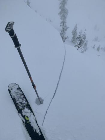
Expect hollowing northerly winds. There is little snow available for transport, but fresh wind slab development is not impossible today. Large cornices remain along steep ridgelines. These should be approached with caution.
Recent Observations
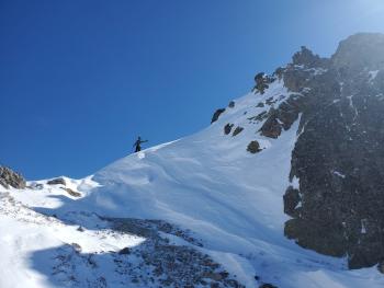
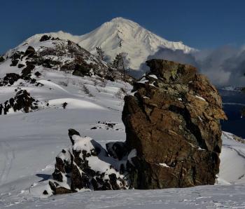
Yesterday was sunny and warm with light winds. On a tour to Gray Rock Lakes and Scott mountain, we observed a mixed bag of conditions. Aspects exposed to the sun were soft and moist. Steep slopes let loose roller balls, pinwheels, and point releases. Dry wind-packed snow was holding on colder shaded aspects. Large cornices are lining the steep north-facing ridgelines. We measured 51 inches (130 cm) total snow depth at 6,000 feet.
Over the past 24 hours:
- Temperatures at our Gray Butte weather station maxed out at 45.5° F at 2 p.m. yesterday. The low was 35° F at 10 p.m.
- Winds were light yesterday but have significantly increased after 10 p.m. last night.
- Northerly winds are currently (4 a.m.) blowing at 35 mi/hr with gusts to 75 mi/hr.
- Our weather station at Old Ski Bowl measures 80.6 inches (206 cm) for total snow depth.

Weather and Current Conditions
Weather Summary
There isn't much to talk about in the weather department today. A high-pressure ridge has moved in, blocking any action. Expect sunny skies with highs in the lower to mid 40s F. The northerly winds have increased and will be strong and gusty. A small storm will bring a chance for light snowfall sometime Friday night or early Saturday morning. Snow totals will be minimal.
24 Hour Weather Station Data @ 4:00 AM
| Weather Station | Temp (°F) | Wind (mi/hr) | Snow (in) | Comments | ||||||||
|---|---|---|---|---|---|---|---|---|---|---|---|---|
| Cur | Min | Max | Avg | Avg | Max Gust | Dir | Depth | New | Water Equivalent | Settlement | ||
| Mt. Shasta City (3540 ft) | 41 | 33 | 58 | 47 | 5 | |||||||
| Sand Flat (6750 ft) | 35 | 25 | 43 | 36 | 0 | 0 | 0 | 0 | Snow sensor down | |||
| Ski Bowl (7600 ft) | 36.5 | 34 | 51 | 40 | 80.6 | 0 | 0 | 1 | ||||
| Gray Butte (8000 ft) | 36 | 35 | 45.5 | 39.5 | 10 | 74 | ESE | |||||
| Castle Lake (5870 ft) | 30 | 30 | 50 | 38 | 67.1 | 0 | 1.3 | |||||
| Mount Eddy (6509 ft) | 29.5 | 29.5 | 47.5 | 39 | 3 | 9 | SE | 61.3 | 0 | 0.6 | ||
| Ash Creek Bowl (7250 ft) | 26.5 | 26.5 | 46 | 34 | 58.5 | 0 | 1 | |||||
| Ash Creek Ridge (7895 ft) | 25 | 24 | 41 | 31.5 | 16 | 40 | WNW |
Two Day Mountain Weather Forecast
Produced in partnership with the Medford NWS
| For 7000 ft to 9000 ft | |||
|---|---|---|---|
|
Tuesday (4 a.m. to 10 p.m.) |
Tuesday Night (10 p.m. to 4 a.m.) |
Wednesday (4 a.m. to 10 p.m.) |
|
| Weather | Sunny | Clear | Sunny |
| Temperature (°F) | 41 | 20 | 35 |
| Wind (mi/hr) | North 10-15 | Northwest 10-15 | North 10-15 |
| Precipitation SWE / Snowfall (in) | 0.00 / 0 | 0.00 / 0 | 0.00 / 0 |
| For 9000 ft to 11000 ft | |||
| Tuesday | Tuesday Night | Wednesday | |
| Weather | Sunny | Clear | Sunny |
| Temperature (°F) | 27 | 22 | 27 |
| Wind (mi/hr) | North 50-60 | North 30-35 | North 40-45 |
| Precipitation SWE / Snowfall (in) | 0.00 / 0 | 0.00 / 0 | 0.00 / 0 |
Season Precipitation for Mount Shasta City
| Period | Measured (in) | Normal (in) | Percent of Normal (%) |
|---|---|---|---|
| From Oct 1, 2025 (the wet season) | 13.58 | 27.87 | 49 |
| Month to Date (since Jul 1, 2026) | 2.14 | 5.60 | 38 |
| Year to Date (since Jan 1, 2026) | 10.00 | 12.66 | 79 |

