

You are here
Avalanche Forecast for 2021-02-26 05:15
- EXPIRED ON February 27, 2021 @ 5:15 amPublished on February 26, 2021 @ 5:15 am
- Issued by Aaron Beverly - Mount Shasta Avalanche Center
Bottom Line
Avalanche danger is low. Be prepared for dangerous northerly winds above treeline. Colder temperatures and winds will keep snow surfaces firm. Slide-for-life conditions exist.


Avalanche Problem 1: Normal Caution
-
Character ?

-
Likelihood ?CertainVery LikelyLikelyPossible
 Unlikely
 -
Size ?HistoricVery LargeLargeSmall

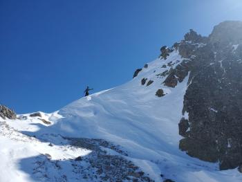
Strong to gale force northwest winds will continue to pummel the mountain. Be prepared for cold temperatures and firm snow surfaces. An ice axe and crampons are mandatory if climbing onto steep slopes, but know that they may not save you if you fall.
Forecast Discussion
A Level I avalanche course is being offered March 5-7 through College of the Siskiyous. Click here for more info.
Recent Observations
Temperatures reached 41 °F yesterday on Mount Shasta. Sustained northwest winds maxed out at 48 mi/hr and gusted to 86. Paul is looking for gloves that got blown away in the ridiculous high winds. If you are in Redding, keep an eye out for them.
Seriously folks, the winds have been insanely strong and will continue to be. Snow surfaces are firm. Climbing the mountain right now is not recommended.

Weather and Current Conditions
Weather Summary
As usual, we are going to get skunked. The weather expected to bring precipitation will be just slightly north of us. We will get wind -- from the northwest -- and it will blow your tents away. Bundle up for low temperatures and low wind chills. Snow surfaces are unlikely to soften except at low elevations.
24 Hour Weather Station Data @ 4:00 AM
| Weather Station | Temp (°F) | Wind (mi/hr) | Snow (in) | Comments | ||||||||
|---|---|---|---|---|---|---|---|---|---|---|---|---|
| Cur | Min | Max | Avg | Avg | Max Gust | Dir | Depth | New | Water Equivalent | Settlement | ||
| Mt. Shasta City (3540 ft) | 36 | |||||||||||
| Sand Flat (6750 ft) | 30 | 20 | 39 | 33 | 0 | 0 | Snow sensor down | |||||
| Ski Bowl (7600 ft) | 32.5 | 27 | 41 | 34.5 | 77.2 | 0 | 0 | 1.5 | ||||
| Gray Butte (8000 ft) | 32 | 29 | 37.5 | 33.5 | 30 | 86 | NW | |||||
| Castle Lake (5870 ft) | 21 | 21 | 40 | 30.5 | 65.3 | 0.8 | 0 | |||||
| Mount Eddy (6509 ft) | 20.5 | 20.5 | 36.5 | 30 | 3 | 8 | SSE | 59.6 | 0 | 0.1 | ||
| Ash Creek Bowl (7250 ft) | 19 | 19 | 35.5 | 27.5 | 57.5 | 0 | 0.3 | |||||
| Ash Creek Ridge (7895 ft) | 15.5 | 15.5 | 28.5 | 23.5 | 22 | 43 | W |
Two Day Mountain Weather Forecast
Produced in partnership with the Medford NWS
| For 7000 ft to 9000 ft | |||
|---|---|---|---|
|
Friday (4 a.m. to 10 p.m.) |
Friday Night (10 p.m. to 4 a.m.) |
Saturday (4 a.m. to 10 p.m.) |
|
| Weather | Sunny. Breezy. | Mostly clear. | Mostly sunny. |
| Temperature (°F) | 32 | 22 | 32 |
| Wind (mi/hr) | Northwest 20-25 | Northwest 15-20 | Northwest 15-20 |
| Precipitation SWE / Snowfall (in) | 0.00 / 0 | 0.00 / 0 | 0.00 / 0 |
| For 9000 ft to 11000 ft | |||
| Friday | Friday Night | Saturday | |
| Weather | Sunny. Very windy. Low wind chills. | Partly cloudy. Very windy. Low wind chills. | Mostly sunny. Very windy. Low wind chills. |
| Temperature (°F) | 20 | 13 | 20 |
| Wind (mi/hr) | Northwest 45-55 | Northwest 50-60 | North 50-60 |
| Precipitation SWE / Snowfall (in) | 0.00 / 0 | 0.00 / 0 | 0.00 / 0 |
Season Precipitation for Mount Shasta City
| Period | Measured (in) | Normal (in) | Percent of Normal (%) |
|---|---|---|---|
| From Oct 1, 2025 (the wet season) | 13.58 | 28.69 | 47 |
| Month to Date (since Jul 1, 2026) | 2.14 | 6.42 | 33 |
| Year to Date (since Jan 1, 2026) | 10.00 | 13.48 | 74 |

