

You are here
Avalanche Forecast for 2021-03-18 06:48
- EXPIRED ON March 19, 2021 @ 6:48 amPublished on March 18, 2021 @ 6:48 am
- Issued by Nick Meyers - Shasta-Trinity National Forest
Bottom Line
A warm winter storm is expected today, but slow to start. The avalanche danger will rise later in the day as heavy snow and wind create wind and storm slab concerns. Snow, wind and weather conditions can vary drastically between Mt. Shasta, Castle Lake and the Eddy Mountains. Monitor changing conditions throughout the day.


Avalanche Problem 1: Wind Slab
-
Character ?

-
Aspect/Elevation ?
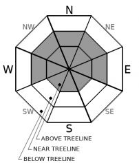
-
Likelihood ?CertainVery LikelyLikelyPossible
 Unlikely
 -
Size ?HistoricVery LargeLargeSmall

New snow and very strong wind blowing out of the south will distribute new wind slabs across northerly facing slopes, but not limited to. Variations in terrain alignment can form wind slabs on other aspects too. Expect easily triggered slabs along leeward ridgelines. Be cautious in steep, complicated or consequential terrain.
Avalanche Problem 2: Storm Slab
-
Character ?

-
Aspect/Elevation ?
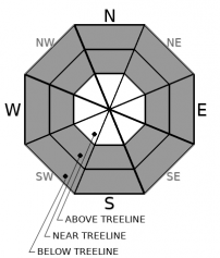
-
Likelihood ?CertainVery LikelyLikelyPossible
Unlikely
-
Size ?HistoricVery LargeLargeSmall
In places where new snowfall is greater than 6 inches, look for signs of a cohesive slab. Storm slabs will rest on a variety of snow surfaces from melt-freeze crusts to powder. Use small test slopes as potential indicators of storm slab instability. Pay attention to this problem immediately during the storm.
Forecast Discussion
Storm day! For the mountains of northern California, lasting avalanche danger and persistent weak layers are uncommon. The period of time when backcountry users need to be most cautious is immediately during or just after a storm. Brief 4-6 hour spikes in avalanche danger are typical. Furthermore, conditions can be drastically different from one side of the interstate to the other. The bottom line is that it's your job to pay attention out there and always look for and heed the 5 red flags of avalanche danger: Recent avalanches (big or small); recent, heavy snow; wind blowing snow; cracking/collapsing; rapid warming.
Recent Observations
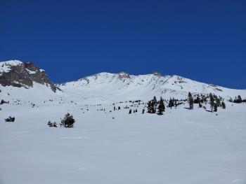
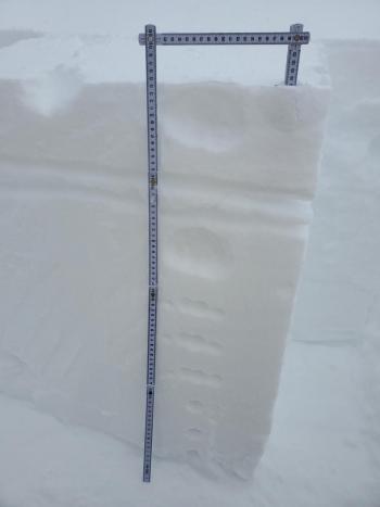
The last couple of days have been pleasant and mild at most elevations (windy on the upper mountain and Mt. Eddy) with no reported or observed avalanches. It's that time of year when you can ride powder on the shady aspects and corn in the sun. It's a variety pack of snow surface conditions leading up to today's storm. A couple of potential weaknesses exist within the snowpack. These include a weak crust and underlying low density snow where easily failures have been observed in pit tests, approximately 20 cm down from the surface, near and above treeline. It's uncertain how much weight would wake up this weak layer. Secondly, in some areas, preserved surface hoar was observed late yesterday afternoon and could be buried by today's storm.
So far this morning as of 0600, the storm is struggling to get started. Snow accumulation is nil and wind is moderate out of the south/southeast.
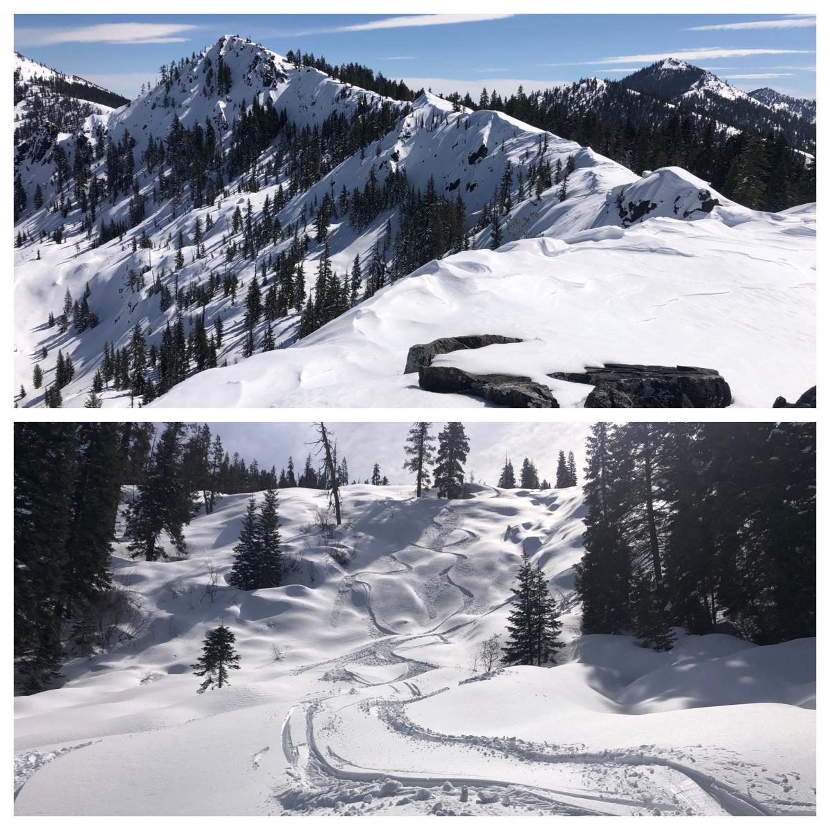
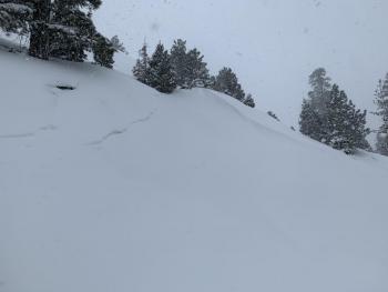
A couple photos from the Etna Summit area yesterday - 3.17.21 [Photo: R Sorenson]
Weather and Current Conditions
Weather Summary
A winter storm warning remains in effect until 11 PM PDT this evening above 4,000 feet. With this warmer storm, expect heavy, wet snow with total accumulations of anywhere from 6 to 12 inches across the forecast area. South wind will gust near 50 to 60 mi/hr over exposed terrain. Snow levels will range from 3,500 to 4,500 feet. A rain and snow mix is possible for Mt. Shasta City during the day. Snow levels will fall after sunset, but precipitation will become showery and less intense. There will be a progressive pattern this weekend into next week with systems arriving via northwest flow. None of these systems are strong, but each will carry with it locally breezy conditions and showers. Spring arrives on March 20th!
24 Hour Weather Station Data @ 4:00 AM
| Weather Station | Temp (°F) | Wind (mi/hr) | Snow (in) | Comments | ||||||||
|---|---|---|---|---|---|---|---|---|---|---|---|---|
| Cur | Min | Max | Avg | Avg | Max Gust | Dir | Depth | New | Water Equivalent | Settlement | ||
| Mt. Shasta City (3540 ft) | 38 | 27 | 47 | 39.5 | 2 | N | ||||||
| Sand Flat (6750 ft) | 28 | 24 | 36 | 28 | Snow sensor down | |||||||
| Ski Bowl (7600 ft) | 24 | 17.5 | 38 | 27 | 84.5 | 0 | 0 | 2.2 | ||||
| Gray Butte (8000 ft) | 23.5 | 19 | 33 | 25 | 7 | 25 | SSE | |||||
| Castle Lake (5870 ft) | 28.5 | 24 | 43.5 | 30.5 | 75.5 | 1.5 | 0 | |||||
| Mount Eddy (6509 ft) | 27 | 21.5 | 36.5 | 29 | 2 | 5 | SSW | 76.3 | 0 | 2.9 | ||
| Ash Creek Bowl (7250 ft) | 25.5 | 19 | 36.5 | 26 | 76 | 0 | 2.4 | |||||
| Ash Creek Ridge (7895 ft) | 22 | 18.5 | 30 | 23 | 11 | 40 | SSE | wind sensor has been rimed |
Two Day Mountain Weather Forecast
Produced in partnership with the Medford NWS
| For 7000 ft to 9000 ft | |||
|---|---|---|---|
|
Thursday (4 a.m. to 10 p.m.) |
Thursday Night (10 p.m. to 4 a.m.) |
Friday (4 a.m. to 10 p.m.) |
|
| Weather | Snow and windy. Snow level near 4,300 feet. | Snow showers, windy. Snow level near 4,100 feet. | Snow showers, mostly cloudy. Snow level near town level. |
| Temperature (°F) | 30 | 20 | 28 |
| Wind (mi/hr) | South 25-35 | South 10-15 | South 10-15 |
| Precipitation SWE / Snowfall (in) | 0.70 / 4-9 | 0.38 / 2-4 | 0.06 / 1-2 |
| For 9000 ft to 11000 ft | |||
| Thursday | Thursday Night | Friday | |
| Weather | Snow, heavy at times, very windy. | Snow showers, widespread blowing snow, very windy. | Snow showers, mostly cloudy, windy. |
| Temperature (°F) | 19 | 7 | 9 |
| Wind (mi/hr) | South 50-60 | South 50-60 | South 20-30 |
| Precipitation SWE / Snowfall (in) | 0.70 / 6-12 | 0.38 / 3-6 | 0.06 / 1-2 |
Season Precipitation for Mount Shasta City
| Period | Measured (in) | Normal (in) | Percent of Normal (%) |
|---|---|---|---|
| From Oct 1, 2025 (the wet season) | 16.41 | 33.38 | 49 |
| Month to Date (since Jun 1, 2026) | 2.83 | 3.88 | 73 |
| Year to Date (since Jan 1, 2026) | 12.83 | 18.17 | 71 |

