

You are here
Avalanche Forecast for 2021-03-29 06:15
- EXPIRED ON March 30, 2021 @ 6:15 amPublished on March 29, 2021 @ 6:15 am
- Issued by Ryan Sorenson - Mount Shasta Avalanche Center
Bottom Line
A small storm to our north is exiting to the east, causing cooler temperatures and increased northerly winds. Expect firm conditions. Only slopes exposed to prolonged, direct sun will soften. Watch for fresh wind slab development on isolated features in steep terrain. Slide for life conditions could be encountered.


Avalanche Problem 1: Normal Caution
-
Character ?

-
Aspect/Elevation ?
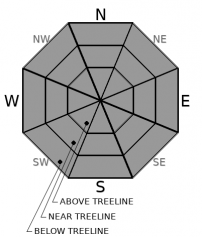
-
Likelihood ?CertainVery LikelyLikelyPossible
 Unlikely
 -
Size ?HistoricVery LargeLargeSmall

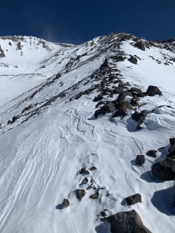
Stronger winds and cooler temperatures will keep it firm today. It isn't warm enough for wet instabilities, but concern for wind slabs is on the menu. Wind out of the northwest is strong enough to blow snow around, but there is little available for transport. Nevertheless, continue to watch for fresh wind slab development on isolated features in steep terrain. Wind slabs will be small but could sweep you off your feet and onto a steep icy slope with exposed rock.
Forecast Discussion
Cool temperatures and strong winds will keep the scoured icy surfaces firm. If attempting to climb, wear a helmet, use an ice axe and crampons, and know how to use them. Self-arrest may be difficult to impossible on these steep icy slopes, and many obstacles exist. Be willing to step back into safer terrain or rope up and place protection if conditions warrant. Watch for falling rocks.
Recent Observations
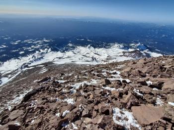
A tour to Middle Peak near Castle Lake yesterday observed cornices along the sharp ridgelines. These are large and nothing to mess with on a sunny day. Skinning up Right Peak snow surfaces were already moist and sticky by the 1030 hour. Snow surfaces are smooth. Breezy westerly winds kept northerly aspects variable. Breakable crusts and smooth softening melt-freeze were the main surface forms seen. No obvious signs of avalanche danger except the cornices were observed.
- In the past 24 hours, at 8,000 feet near treeline on Mt Shasta, strong northwest winds blew last night, averaging 23 mi/hr with gusts to 61 mi/hr. The current temperature at 0500 is 31 °F with a low of 31 °F and a high of 44.5 °F.
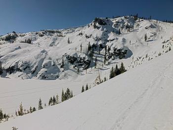
- At treeline, snow depth has settled to approximately 70-75 inches of snow is on the ground with less above treeline due to a windy winter. We apologize as our Old Ski Bowl weather station is down due to electrical issues.
- Coverage is best below and near the treeline. The wind has scored out large patches of exposed rock on moraine tops, ridgelines, and most open slopes above treeline on Mt Shasta.
- More snow exists in gullies, depressions, and on leeward easterly slopes.
- Trailheads on the north and east sides of the mountain are still covered in snow. For a full observation with photos, click here.
- The South Fork has patchy snow and asphalt to approximately 5,000 feet.
Weather and Current Conditions
Weather Summary
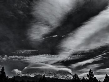
Lingering clouds over the forecast area's western reaches will dissipate this morning. Expect sunny skies and cooler temperatures. Northerly winds will be in the moderate to the strong range. Tonight will be one of the coldest nights this week. A ridge of high pressure is moving in. Expect clear skies and a strong warming trend through the week. Models show a switch to an unsettled weather pattern towards the end of next weekend. Until then, enjoy the sun.
24 Hour Weather Station Data @ 5:00 AM
| Weather Station | Temp (°F) | Wind (mi/hr) | Snow (in) | Comments | ||||||||
|---|---|---|---|---|---|---|---|---|---|---|---|---|
| Cur | Min | Max | Avg | Avg | Max Gust | Dir | Depth | New | Water Equivalent | Settlement | ||
| Mt. Shasta City (3540 ft) | 33 | 31 | 67 | 49.5 | 3 | N | ||||||
| Sand Flat (6750 ft) | 29 | 29 | 54 | 40 | Snow sensor down | |||||||
| Ski Bowl (7600 ft) | Station Down | |||||||||||
| Gray Butte (8000 ft) | 27.5 | 27.5 | 44.5 | 38 | 23 | 61 | NW | |||||
| Castle Lake (5870 ft) | 24 | 24 | 60.5 | 45.5 | 71.3 | 0 | 0.8 | |||||
| Mount Eddy (6509 ft) | 21.5 | 21.5 | 54 | 41 | 2 | 7 | WSW | 68.5 | 0 | 1.9 | ||
| Ash Creek Bowl (7250 ft) | 25 | 25 | 47.5 | 39.5 | 69.9 | 0 | 1.6 | |||||
| Ash Creek Ridge (7895 ft) | 18.5 | 18.5 | 46.5 | 36 | 12 | 42 | WSW |
Two Day Mountain Weather Forecast
Produced in partnership with the Medford NWS
| For 7000 ft to 9000 ft | |||
|---|---|---|---|
|
Monday (4 a.m. to 10 p.m.) |
Monday Night (10 p.m. to 4 a.m.) |
Tuesday (4 a.m. to 10 p.m.) |
|
| Weather | Sunny | Clear | Sunny |
| Temperature (°F) | 33 | 23 | 42 |
| Wind (mi/hr) | North 10-15 | North 10-15 | Northeast 10-15 |
| Precipitation SWE / Snowfall (in) | 0.00 / 0 | 0.00 / 0 | 0.00 / 0 |
| For 9000 ft to 11000 ft | |||
| Monday | Monday Night | Tuesday | |
| Weather | Sunny and windy | Clear | Sunny |
| Temperature (°F) | 27 | 27 | 34 |
| Wind (mi/hr) | North 40-45 | North 35-40 | North 30-35 |
| Precipitation SWE / Snowfall (in) | 0.00 / 0 | 0.00 / 0 | 0.00 / 0 |
Season Precipitation for Mount Shasta City
| Period | Measured (in) | Normal (in) | Percent of Normal (%) |
|---|---|---|---|
| From Oct 1, 2025 (the wet season) | 17.15 | 35.07 | 49 |
| Month to Date (since Jul 1, 2026) | 3.57 | 5.57 | 64 |
| Year to Date (since Jan 1, 2026) | 13.57 | 19.86 | 68 |

