

You are here
Avalanche Forecast for 2021-03-30 06:45
- EXPIRED ON March 31, 2021 @ 6:45 amPublished on March 30, 2021 @ 6:45 am
- Issued by Ryan Sorenson - Mount Shasta Avalanche Center
Bottom Line
Today will be warmer than yesterday, with mostly calm and variable winds. Avalanche danger is low. Triggering an avalanche is unlikely, but small wind slabs and loose wet avalanches are not impossible in steep, isolated terrain. Extreme terrain at higher elevations poses the hazard of a dangerous long sliding fall with many exposed rocks.


Avalanche Problem 1: Normal Caution
-
Character ?

-
Aspect/Elevation ?
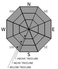
-
Likelihood ?CertainVery LikelyLikelyPossible
 Unlikely
 -
Size ?HistoricVery LargeLargeSmall

High pressure has moved back in bring sunny skies and warming temperatures. Expect firm conditions in the morning with softening in the afternoon. You might see loose roller balls and pinwheels on sunny aspects. If so, it's best to pick a different aspect or come back earlier next time. Mount Shasta has also received a dose of northerly wind over the past few days, and isolated wind slabs in steep terrain are not impossible. These will be small but could sweep an unaware slider off their feet, potentially leading to a fall on steep icy slopes with exposed rock.
Forecast Discussion
With precipitation near 50% of normal for Mt. Shasta City this winter, snow coverage is less than ideal. Certainly, there will be some fantastic climbing and skiing days this Spring, but expect more rockfall than usual, which means increased risk on most routes. Wear a helmet and know how to use your ice axe and crampons if traveling at elevation or in the steeps. Be willing to step back into safer terrain if conditions warrant. A slip and fall on snow that terminates into boulders is bad news.
Recent Observations
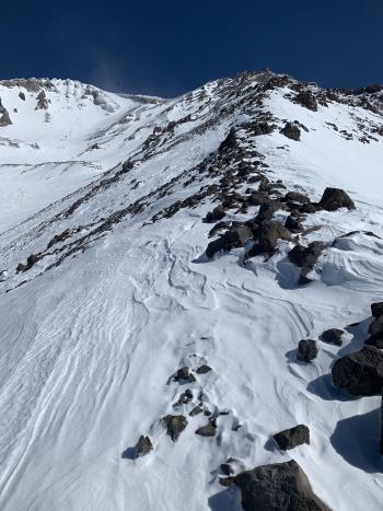
Traveling up to the Gray Rocks snow survey site yesterday, we encountered varied conditions. During morning hours, snow surfaces were firm. Many sticks and branches litter forested areas at lower elevations. South and east-facing slopes were softened by noon. Supportable melt-freeze crusts dominated surface textures at higher elevations. A moderate wind was blowing steadily from the north. Creeks around Methodist Camp were still filled in. The average snow depth was 74 inches with a snow water equivalent (SWE) of 30 inches. Click here for more data.
- In the past 24 hours, at 8,000 feet near treeline on Mt Shasta, winds have been light and variable, averaging 26 mi/hr with gusts to 25 mi/hr. The current temperature at 0500 is 24 °F with a low of 21.5 °F and a high of 33.5 °F.
- At treeline, snow depth has settled to approximately 70-75 inches of snow is on the ground with less above treeline due to a windy winter. We apologize as our Old Ski Bowl weather station is down due to electrical issues.
- Coverage is best below and near the treeline. The wind has scored out large patches of exposed rock on moraine tops, ridgelines, and most open slopes above treeline on Mt Shasta.
- More snow exists in gullies, depressions, and on leeward easterly slopes.
- Trailheads on the north and east sides of the mountain are still covered in snow. For a full observation with photos, click here.
- The South Fork has patchy snow and asphalt to approximately 5,000 feet.
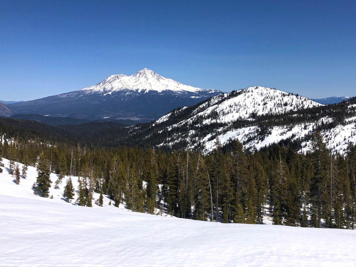
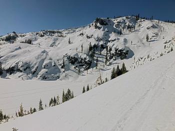
The view looking down Scott Camp Creek yesterday. {3.29.21 Photos: Sorenson}
Weather and Current Conditions
Weather Summary
High pressure will do what it does, clear skies and warm temperatures today. The northerly winds will be less strong than yesterday. Our next chances for precipitation are a skiff on Sunday morning then a cold front arriving on Monday and Tuesday of next week.
24 Hour Weather Station Data @ 5:00 AM
| Weather Station | Temp (°F) | Wind (mi/hr) | Snow (in) | Comments | ||||||||
|---|---|---|---|---|---|---|---|---|---|---|---|---|
| Cur | Min | Max | Avg | Avg | Max Gust | Dir | Depth | New | Water Equivalent | Settlement | ||
| Mt. Shasta City (3540 ft) | 33 | 31 | 67 | 49.5 | 3 | N | ||||||
| Sand Flat (6750 ft) | 21 | 18 | 34 | 26 | Snow sensor down | |||||||
| Ski Bowl (7600 ft) | Station Down | |||||||||||
| Gray Butte (8000 ft) | 37.5 | 21.5 | 37.5 | 27 | 7 | 49 | SW | |||||
| Castle Lake (5870 ft) | 21.5 | 19.5 | 37.5 | 28 | 69.6 | 0 | 1.7 | |||||
| Mount Eddy (6509 ft) | 29.5 | 15 | 35 | 27.5 | 3 | 10 | S | 68.4 | 0 | 0.4 | ||
| Ash Creek Bowl (7250 ft) | 33 | 14 | 33 | 23.5 | 69.4 | 0 | 0.5 | |||||
| Ash Creek Ridge (7895 ft) | 17 | 10.5 | 26.5 | 18 | 5 | 21 | NNW |
Two Day Mountain Weather Forecast
Produced in partnership with the Medford NWS
| For 7000 ft to 9000 ft | |||
|---|---|---|---|
|
Tuesday (4 a.m. to 10 p.m.) |
Tuesday Night (10 p.m. to 4 a.m.) |
Wednesday (4 a.m. to 10 p.m.) |
|
| Weather | Sunny | Clear | Sunny |
| Temperature (°F) | 43 | 30 | 56 |
| Wind (mi/hr) | Northeast 10-15 | Northeast 5-10 | East 5-10 |
| Precipitation SWE / Snowfall (in) | 0.00 / 0 | 0.00 / 0 | 0.00 / 0 |
| For 9000 ft to 11000 ft | |||
| Tuesday | Tuesday Night | Wednesday | |
| Weather | Sunny | Clear | Sunny |
| Temperature (°F) | 33 | 33 | 40 |
| Wind (mi/hr) | Northeast 15-20 | Northeast 15-20 | Southeast 10-15 |
| Precipitation SWE / Snowfall (in) | 0.00 / 0 | 0.00 / 0 | 0.00 / 0 |
Season Precipitation for Mount Shasta City
| Period | Measured (in) | Normal (in) | Percent of Normal (%) |
|---|---|---|---|
| From Oct 1, 2025 (the wet season) | 17.15 | 35.20 | 49 |
| Month to Date (since Jul 1, 2026) | 3.57 | 5.70 | 63 |
| Year to Date (since Jan 1, 2026) | 13.57 | 19.99 | 68 |

