-
EXPIRED ON March 19, 2018 @ 6:25 amPublished on March 18, 2018 @ 6:25 am
-
Issued by
Andrew Kiefer - Mt Shasta Avalanche Center
Natural and human triggered avalanches are unlikely, and LOW danger exists at all elevations. If westerly winds increase more than expected over the next 24 hours, fresh wind slabs may form in leeward terrain above treeline. As skies clear throughout the day, intense solar radiation will likely cause roller balls, pinwheels and inconsequential wet loose activity on steep sun exposed slopes.
Generally safe avalanche conditions. Watch for unstable snow on isolated terrain features.
Generally safe avalanche conditions. Watch for unstable snow on isolated terrain features.
Generally safe avalanche conditions. Watch for unstable snow on isolated terrain features.
Forecast Hotline: (530) 926-9613
Below Treeline is the lowest of three elevation bands used in the advisories. It extends from valley floors or snowline to Near Treeline. Open areas and sparse trees are possible. Snowfall tends to be less than the other elevation bands. Tree cover shelters the snow from wind effects.
×Near Treeline is the middle of the three elevation bands used in the advisories. It is a transition zone between dense forests and treeless alpine areas. It is the narrowest of the three elevation bands, extending only a few hundred feet above and below the treeline. It varies locally, and is not a constant elevation or width.
×Above Treeline is the highest of the three elevation bands used in the advisories. It includes alpine areas where the most snow falls and the winds are the strongest. It is not an exact elevation, but a characteristic of the terrain, beginning as the treeline transitions into open slopes extending to ridges and the tops of the highest peaks.
×North American Avalanche Danger Scale
Avalanche danger is determined by the likelihood, size and distribution of avalanches.
Watch for signs of unstable snow such as recent avalanches, cracking in the snow, and audible collapsing. Avoid traveling on or under similar slopes.
Safe backcountry travel requires training and experience. You control your own risk by choosing where, when and how you travel.
North American Avalanche Danger Scale
Avalanche danger is determined by the likelihood, size and distribution of avalanches.
Generally safe avalanche conditions. Watch for unstable snow on isolated terrain features.
Natural and human-triggered avalanches unlikely.
Small avalanches in isolated areas or extreme terrain.
Safe backcountry travel requires training and experience. You control your own risk by choosing where, when and how you travel.
North American Avalanche Danger Scale
Avalanche danger is determined by the likelihood, size and distribution of avalanches.
Heightened avalanche conditions on specific terrain features. Evaluate snow and terrain carefully; identify features of concern.
Natural avalanches unlikely; human-triggered avalanches possible.
Small avalanches in specific areas; or large avalanches in isolated areas.
Safe backcountry travel requires training and experience. You control your own risk by choosing where, when and how you travel.
North American Avalanche Danger Scale
Avalanche danger is determined by the likelihood, size and distribution of avalanches.
Dangerous avalanche conditions. Careful snowpack evaluation, cautious route-finding and conservative decision making essential.
Natural avalanches possible; human triggered avalanches likely.
Small avalanches in many areas; or large avalanches in specific areas; or very large avalanches in isolated areas.
Safe backcountry travel requires training and experience. You control your own risk by choosing where, when and how you travel.
North American Avalanche Danger Scale
Avalanche danger is determined by the likelihood, size and distribution of avalanches.
Very dangerous avalanche conditions. Travel in avalanche terrain not recommended.
Natural avalanches likely; human-triggered avalanches very likely.
Large avalanches in many areas; or very large avalanches in specific areas.
Safe backcountry travel requires training and experience. You control your own risk by choosing where, when and how you travel.
North American Avalanche Danger Scale
Avalanche danger is determined by the likelihood, size and distribution of avalanches.
Avoid all avalanche terrain.
Natural and human-triggered avalanches certain.
Large to very large avalanches in many areas.
Safe backcountry travel requires training and experience. You control your own risk by choosing where, when and how you travel.
Weather and Current Conditions
Disclaimer
This advisory does not apply to Ski Areas or Highways and is for the Mount Shasta, Castle Lake and Mount Eddy backcountry. Use this information for guidance only. You may find different conditions in the backcountry and should travel accordingly. This advisory expires on midnight of the date it was posted unless otherwise noted.


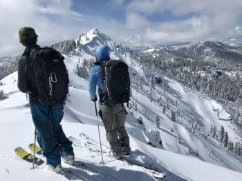
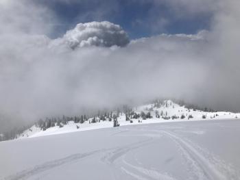
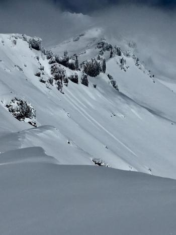
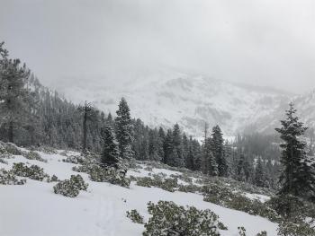
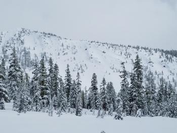
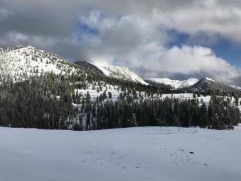
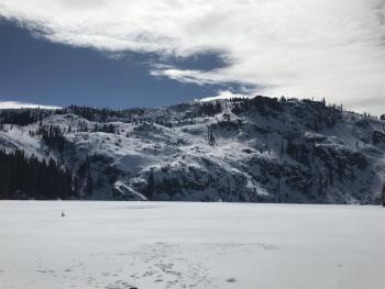

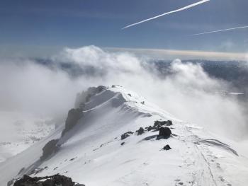
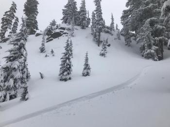
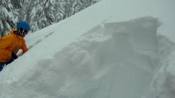
Observations during a tour from Pilgrim Creek Snowmobile Park to Rainbow Mountain, northeast of Ash Creek Butte: